

Description
Product Description:
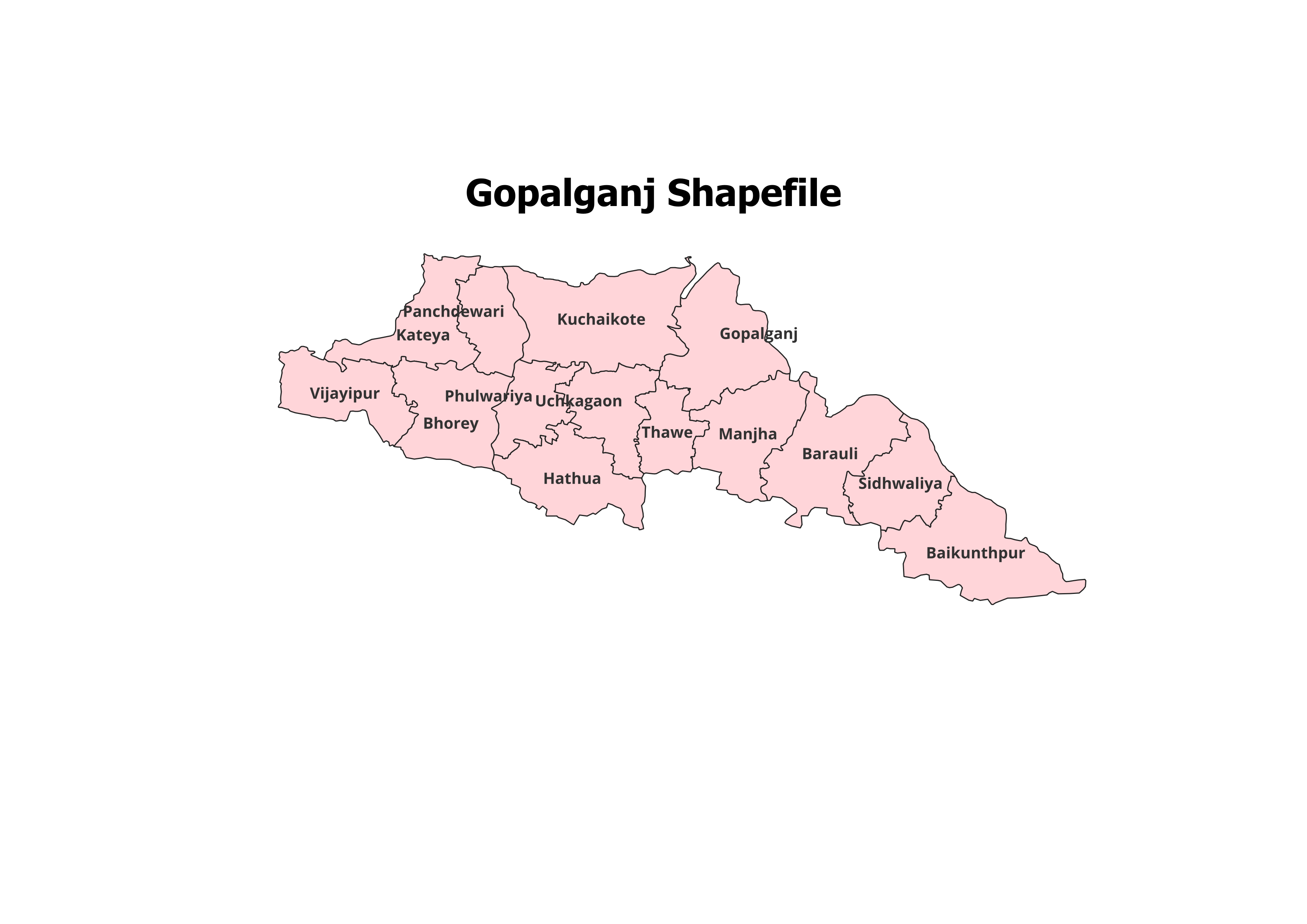
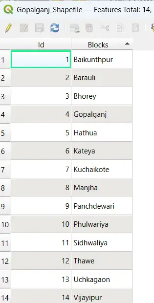
Access the detailed geographical boundaries of Gopalganj District with our precise and reliable shapefile. This dataset includes the administrative boundaries of Gopalganj District and its 14 Blocks, making it an indispensable resource for GIS professionals, researchers, and students.
Key Features:
- Complete Block-Level Coverage: Includes all 14 blocks of Gopalganj District.
- Accurate and Verified Data: Ideal for academic, research, and personal projects.
- GIS-Ready Format: Seamless integration with QGIS, ArcGIS, and other GIS platforms.
- Detailed Attributes: Includes block names and codes for enhanced spatial analysis.
- File Format: ESRI Shapefile (.shp) with all necessary files (.dbf, .shx, .prj).
Applications:
- Research Studies: Perfect for land use planning, population distribution analysis, and development projects.
- Academic Projects: An essential dataset for GIS mapping and presentations.
- Non-Commercial Use: Designed for educational and personal purposes.
Blocks Included in Gopalganj District:
- Baikunthpur
- Barauli
- Bhorey
- Hathua
- Kuchaikote
- Manjha
- Panchdeori
- Sidhwalia
- Thawe
- Uchkagaon
- Vijayipur
- Gopalganj
- Kateya
- Phulwaria
Technical Details:
- File Format: ESRI Shapefile (.shp)
- Coordinate System: WGS 84 (EPSG: 4326)
- Resolution: High-quality vector data
- Attributes: Includes block names, codes, and metadata
Important Notes:
- Commercial Use: Not Allowed. This shapefile is intended for academic, research, or personal use only.
- Redistribution or Resale: Strictly prohibited.
What You’ll Receive:
- Shapefile of Gopalganj District
- Metadata with block-level attributes
- Easy setup instructions for GIS integration
- Free technical support for troubleshooting and usage
Compatibility:
Compatible with popular GIS tools, including:
- QGIS
- ArcGIS
- Global Mapper
- MapInfo
- AutoCAD Map 3D
Licensing:
- Personal and Academic Use Only
- Redistribution, resale, or commercial use is strictly prohibited.
Manish (verified owner) –
A must-visit site for anyone in need of high-quality geospatial data. Amazing collection.
Karan (verified owner) –
This website offers incredible value. The shapefiles are clean, accurate, and easy to work with.
Jatin (verified owner) –
I purchased a district boundary shapefile and it worked flawlessly in my software. Great job.
Riya (verified owner) –
The best platform for high-quality GIS shapefiles. Everything I needed was easy to find and download.
Shruti (verified owner) –
I downloaded ecological shapefiles for a conservation project and the quality was fantastic.
Anjali (verified owner) –
The boundary shapefiles were incredibly accurate. Will definitely use this site again.
Yash (verified owner) –
I’ve recommended this site to my team. The datasets are consistently accurate and detailed.