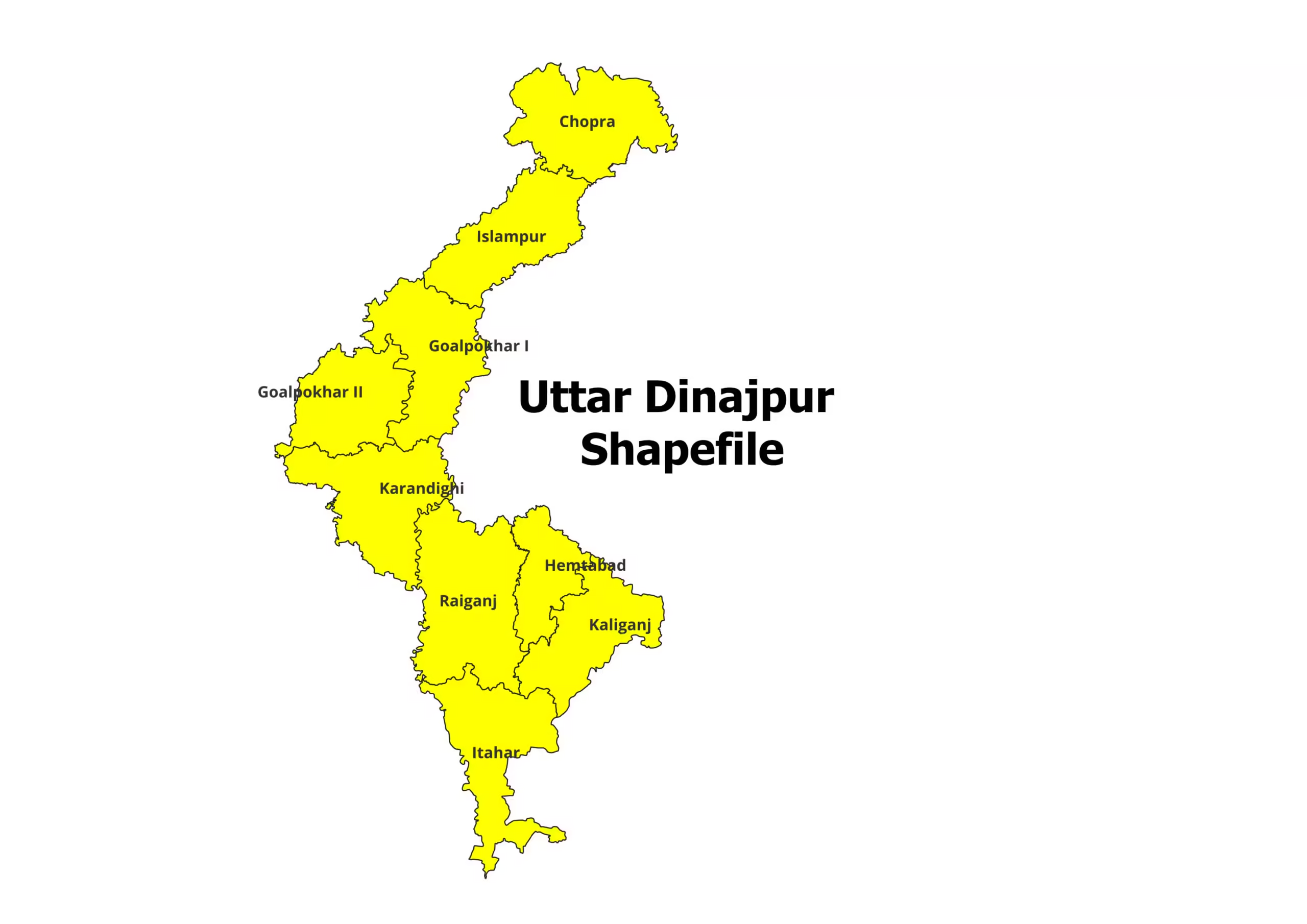
Uttar Dinajpur District and Blocks Shapefile (2026)
Are you working on a project related to the Uttar Dinajpur District in West Bengal, India? Do you need the…
Read More Are you working on a project related to the Uttar Dinajpur District in West Bengal, India? Do you need the…
Read More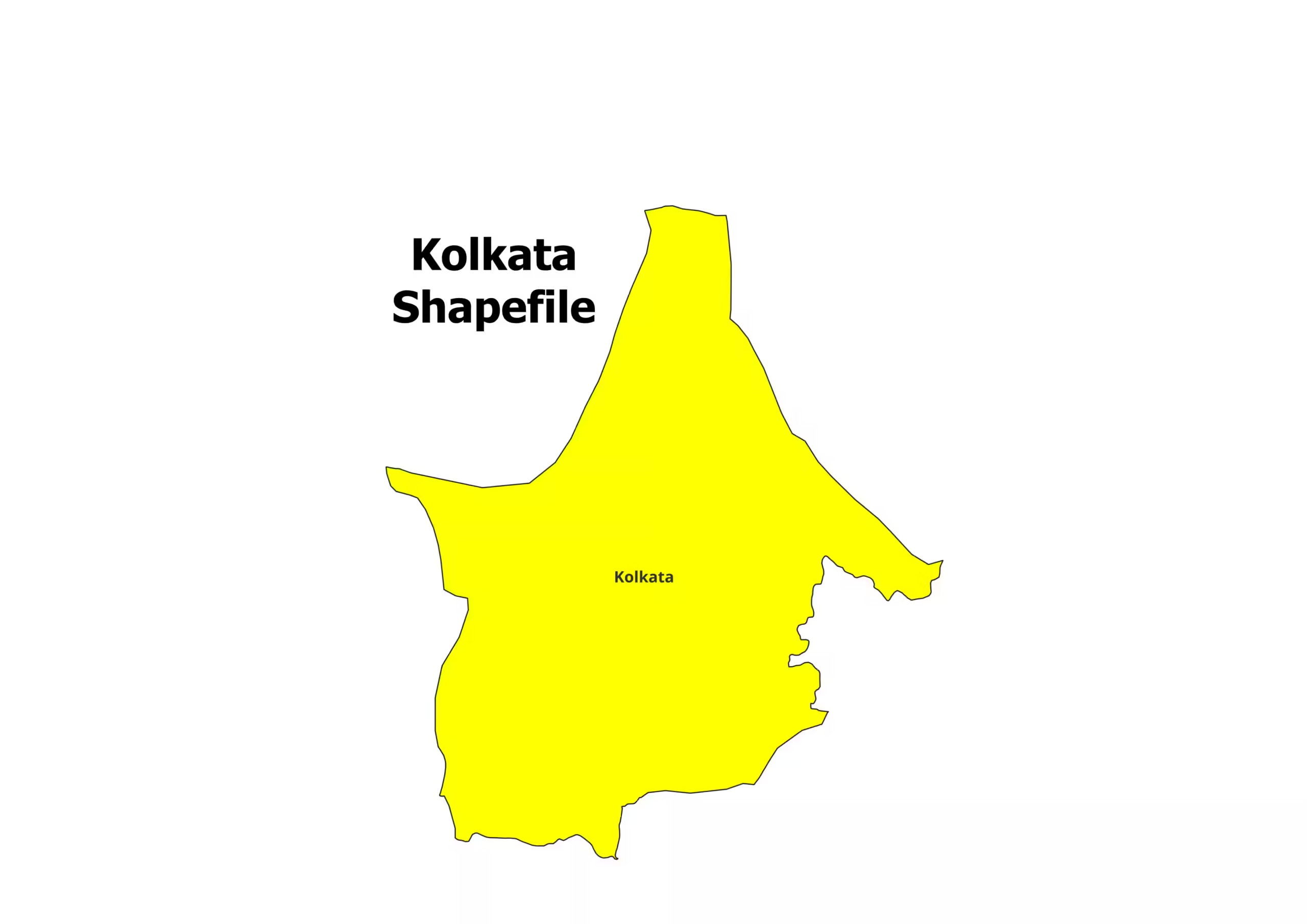
Are you working on a project related to the Kolkata district in West Bengal, India? Do you need the Kolkata…
Read More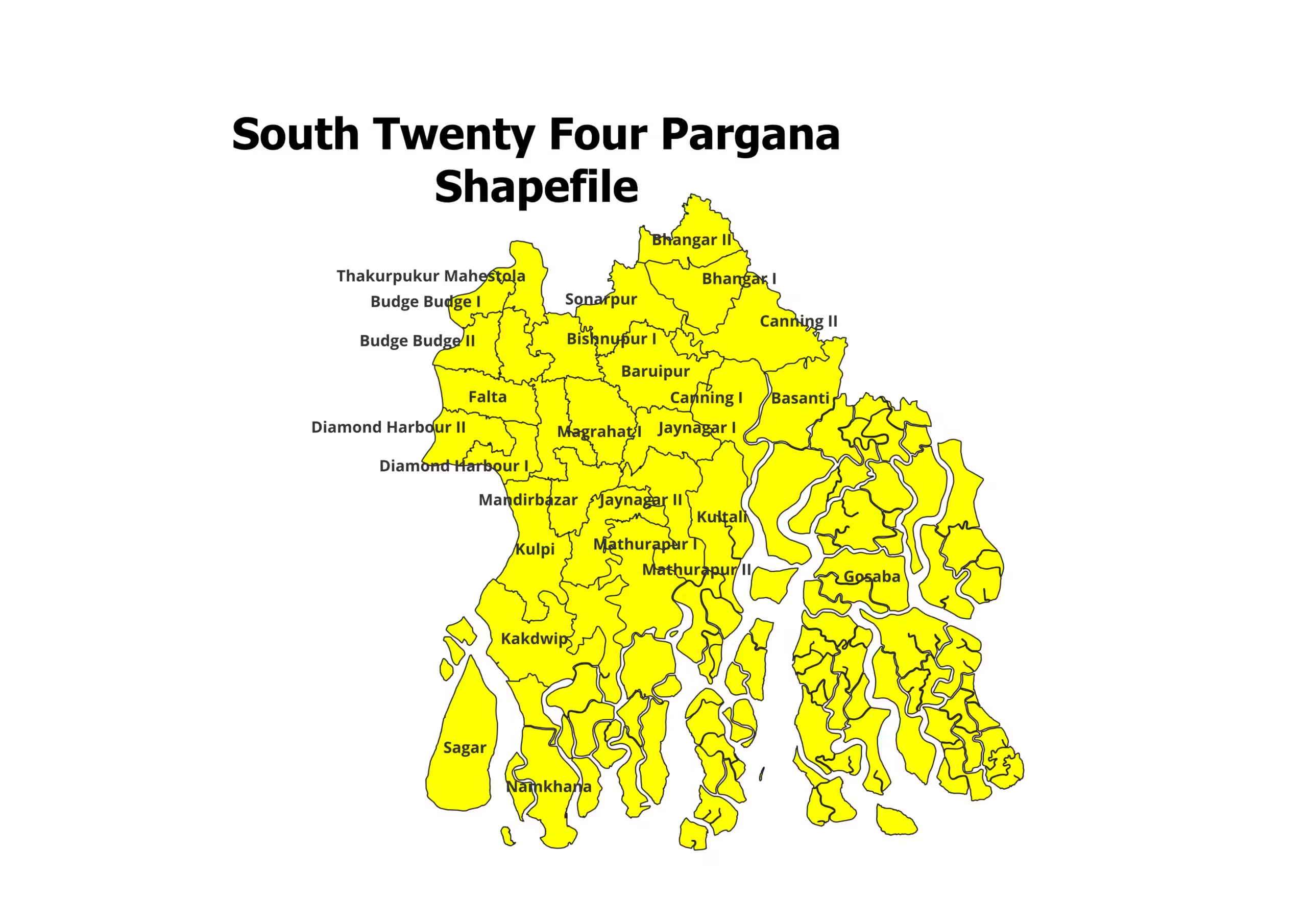
Are you working on a project related to the South Twenty Four Pargana district in West Bengal, India? Do you…
Read More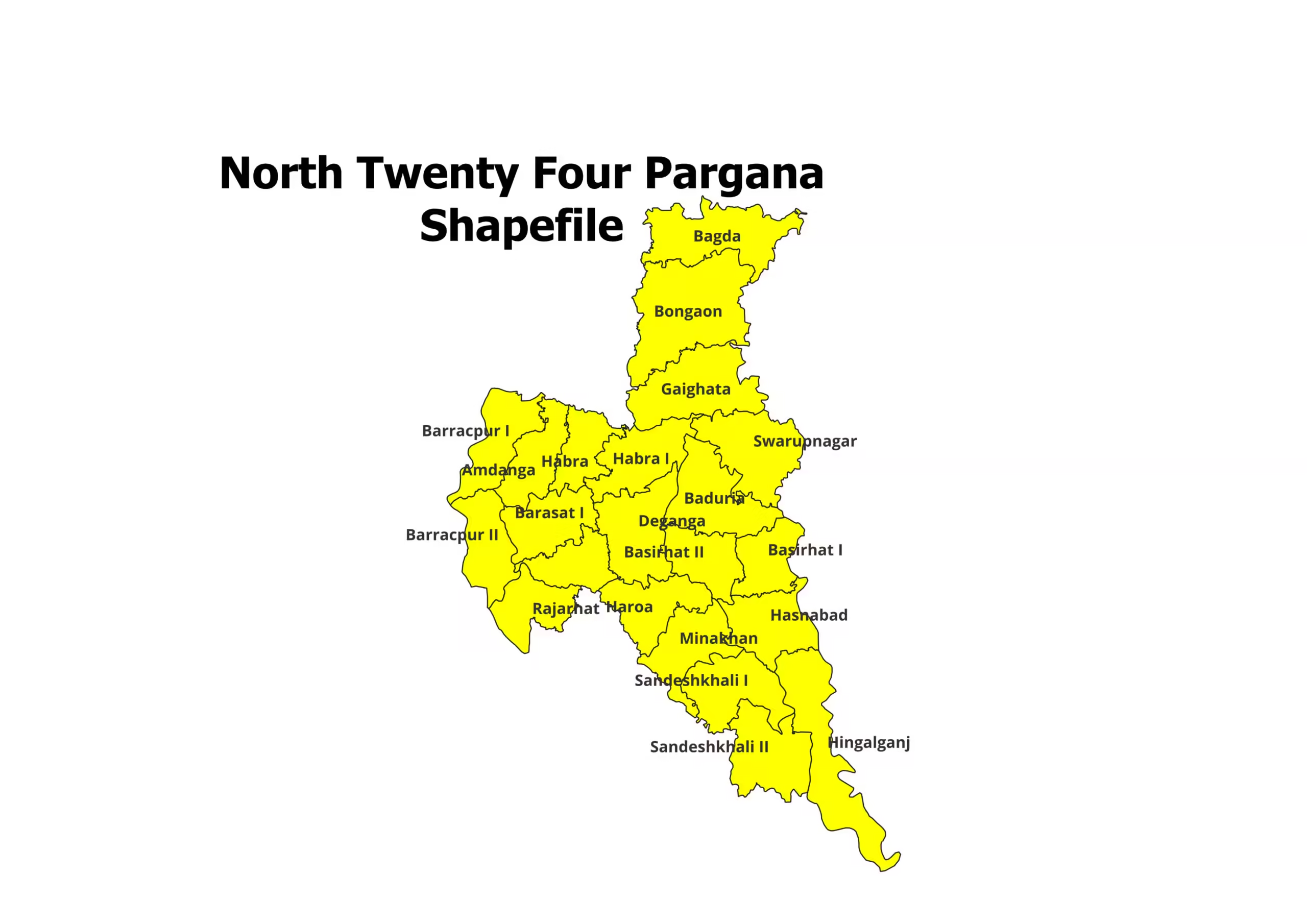
Are you working on a project related to the North Twenty Four Pargana district in West Bengal, India? Do you…
Read More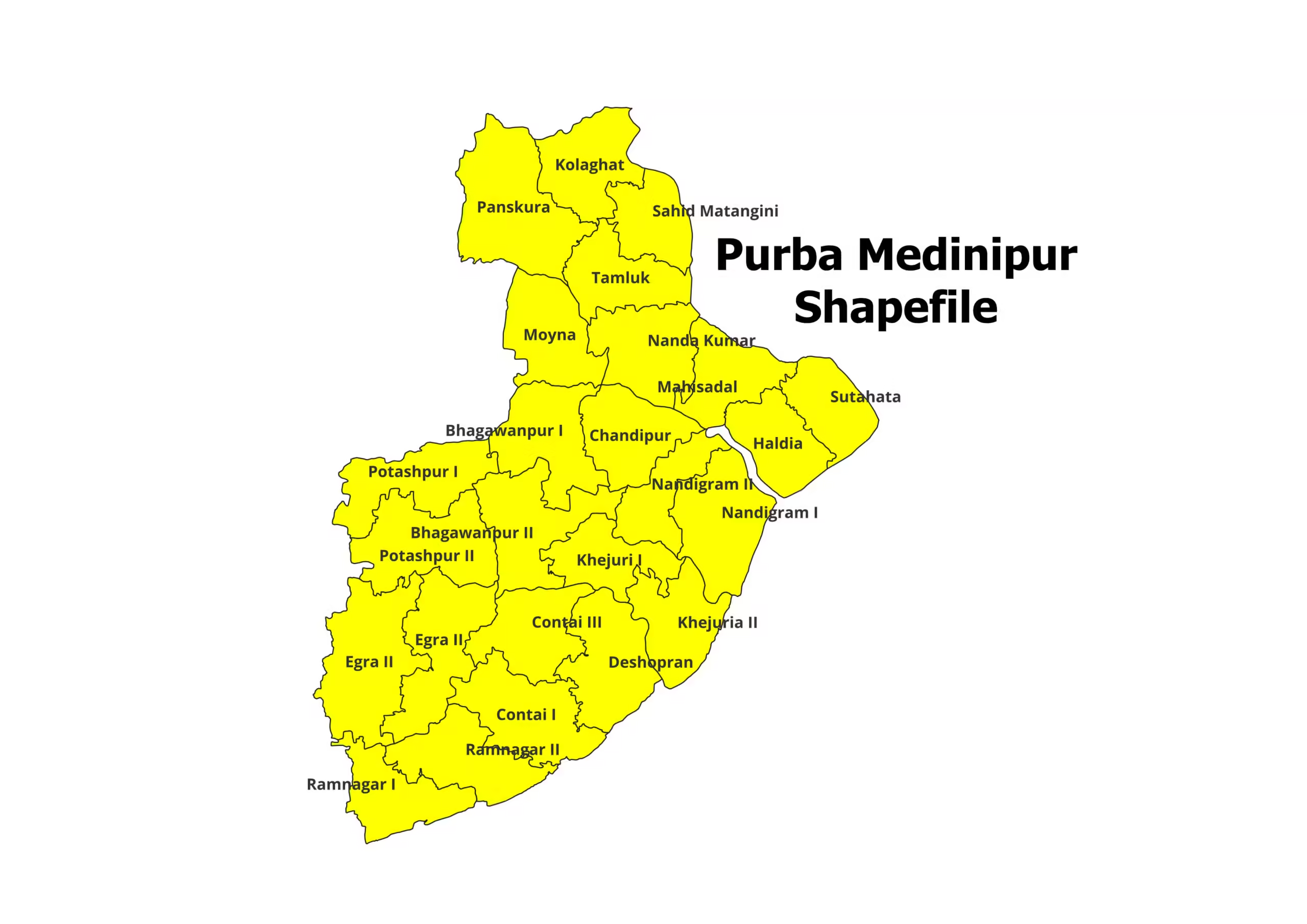
Are you working on a project related to the Purba Medinipur district in West Bengal, India? Do you need the…
Read More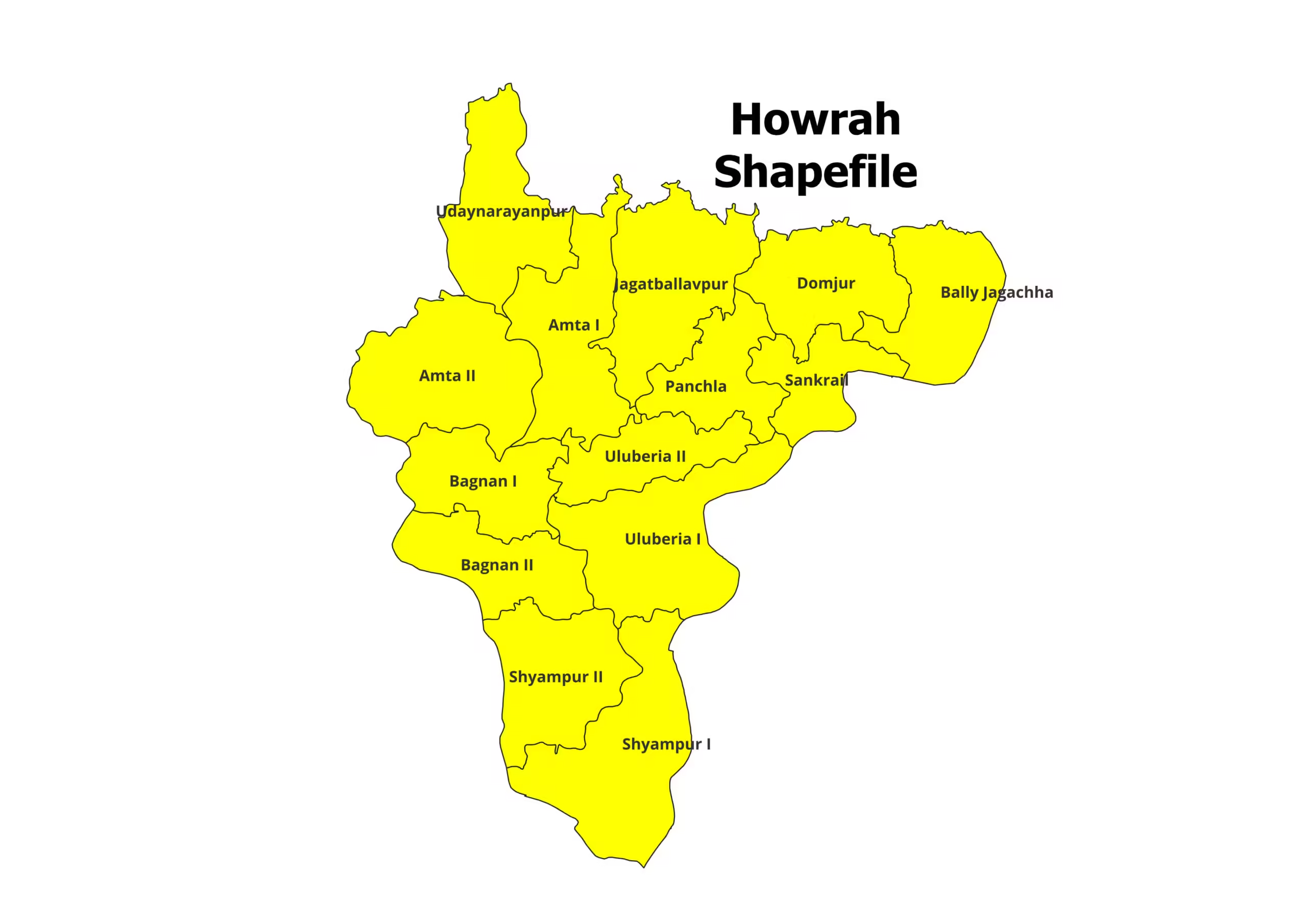
Are you working on a project related to the Howrah district in West Bengal, India? Do you need the Howrah…
Read More
Are you working on a project related to the Hooghly district in West Bengal, India? Do you need the Hooghly…
Read More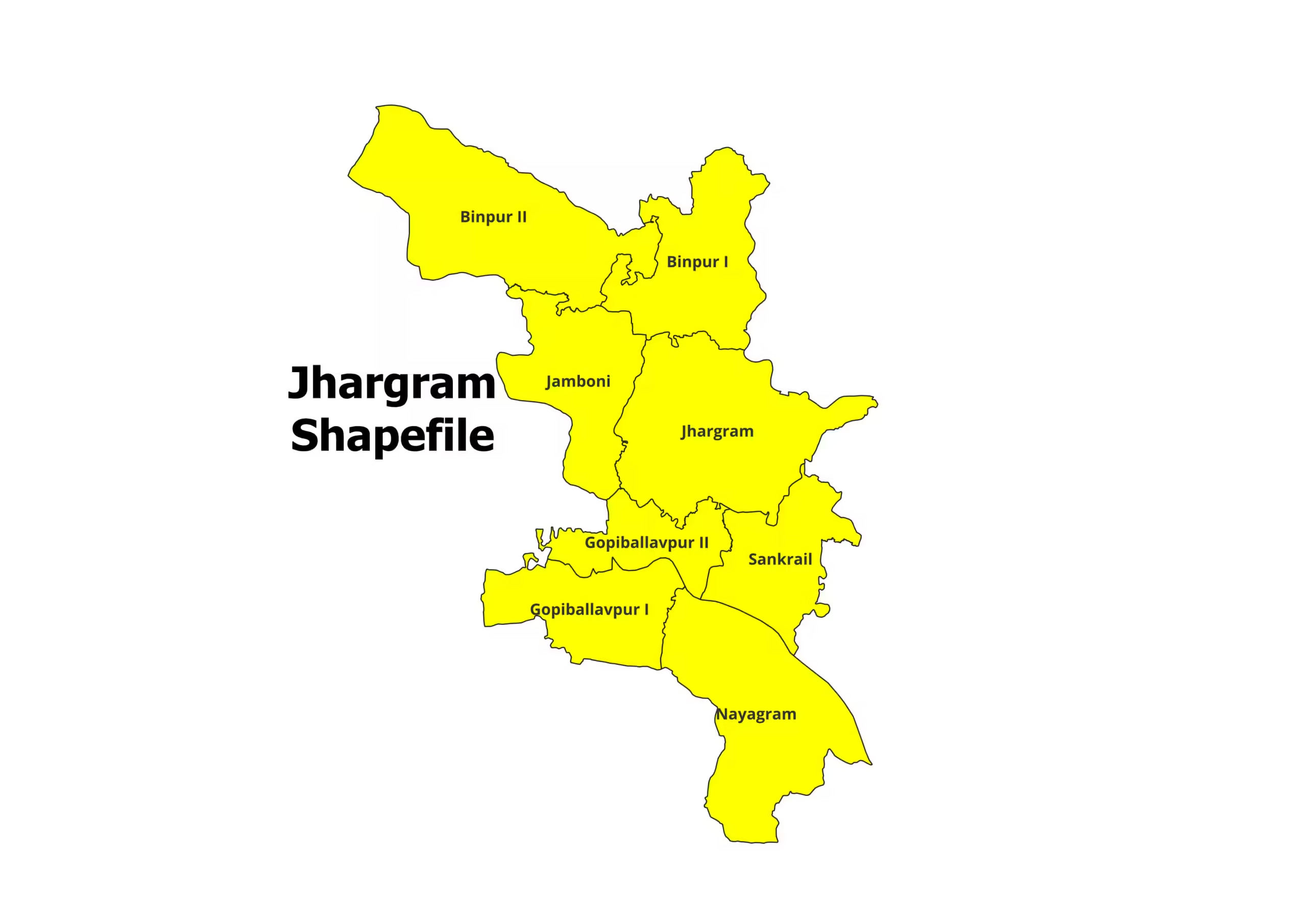
Are you working on a project related to the Jhargram district in West Bengal, India? Do you need the Jhargram…
Read More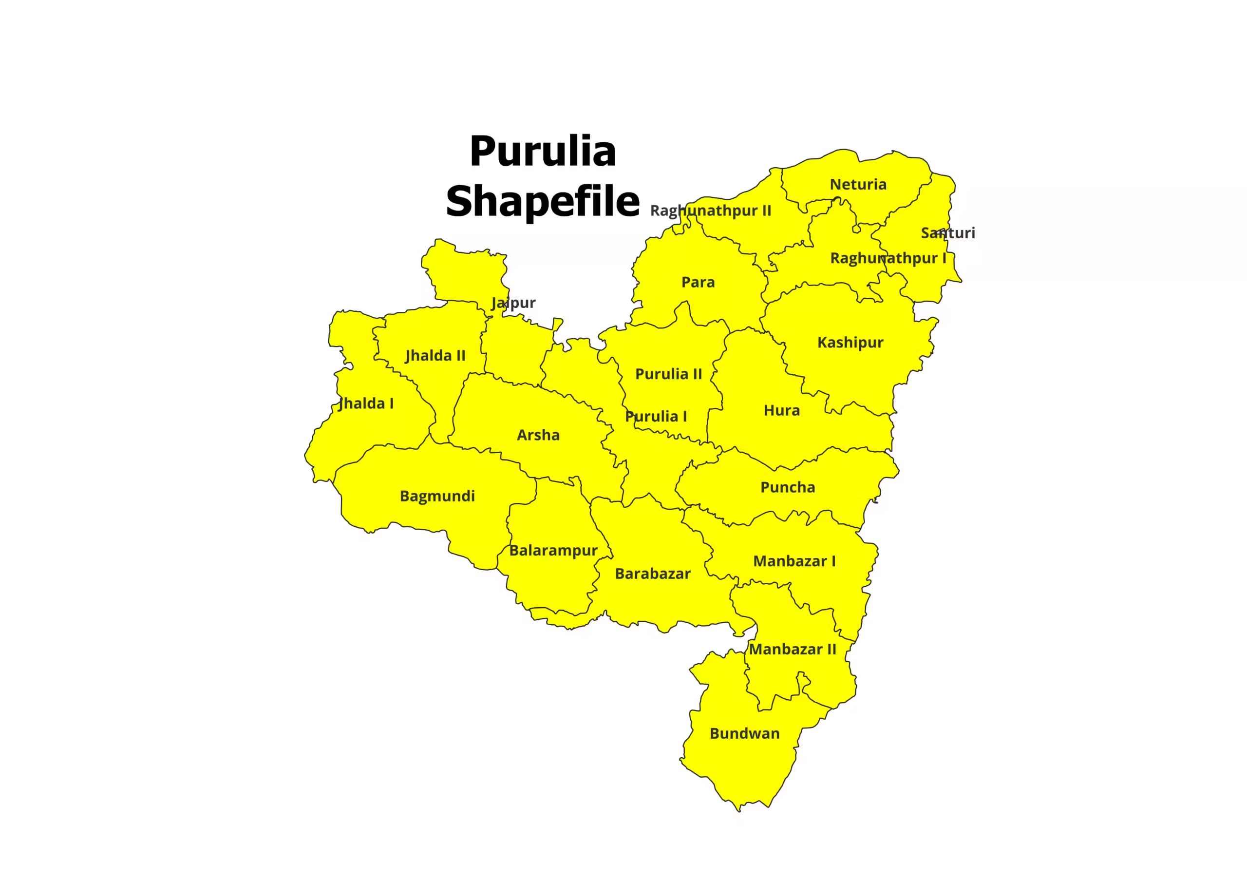
Are you working on a project related to the Purulia district in West Bengal, India? Do you need the Purulia…
Read More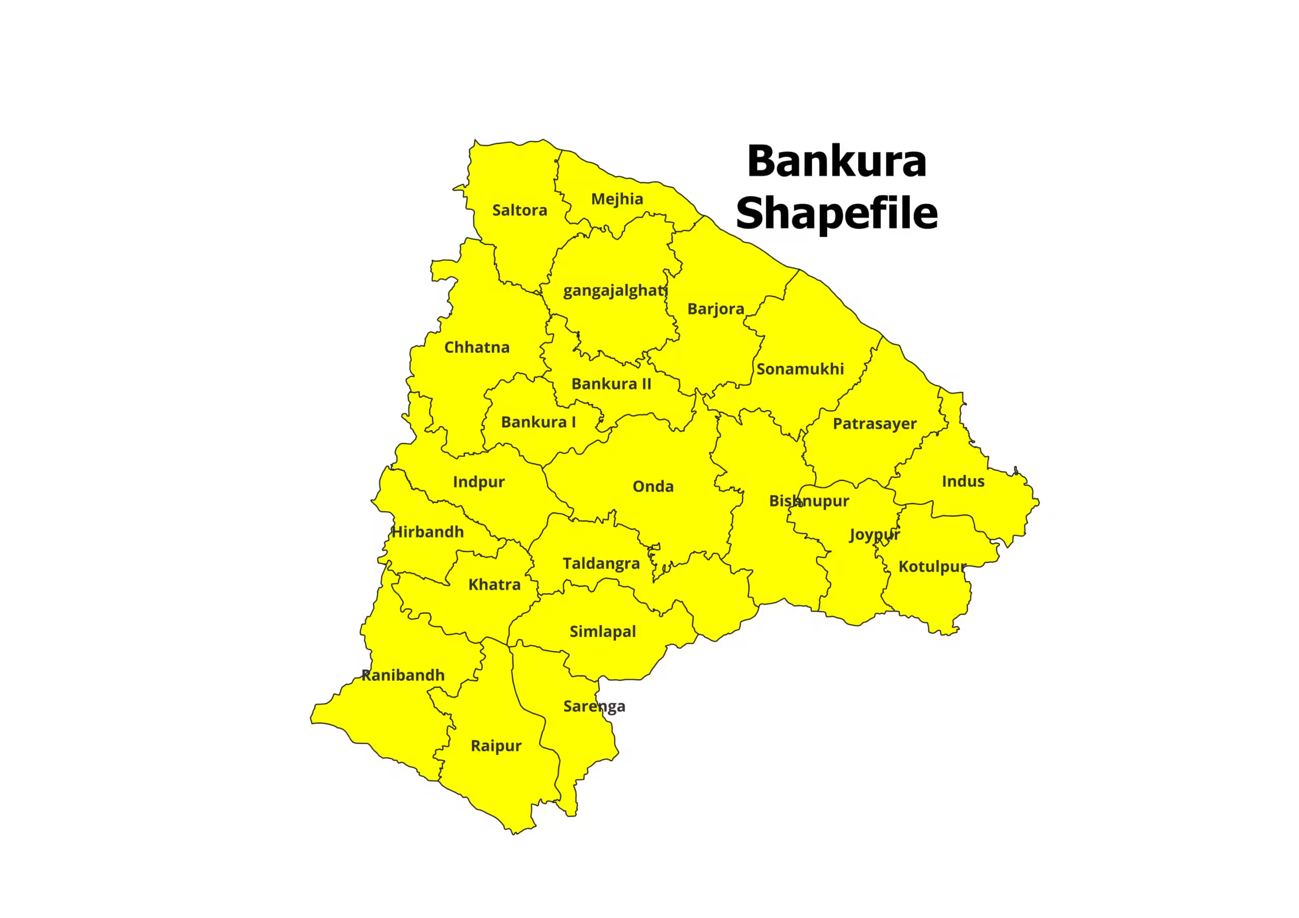
Are you working on a project related to the Bankura district in West Bengal, India? Do you need the Bankura…
Read MoreOur main motive is to share some valuable information and knowledge about various Geographical Phenomenon. Day by day we will cover more topics as possible.