

Description
Product Description:
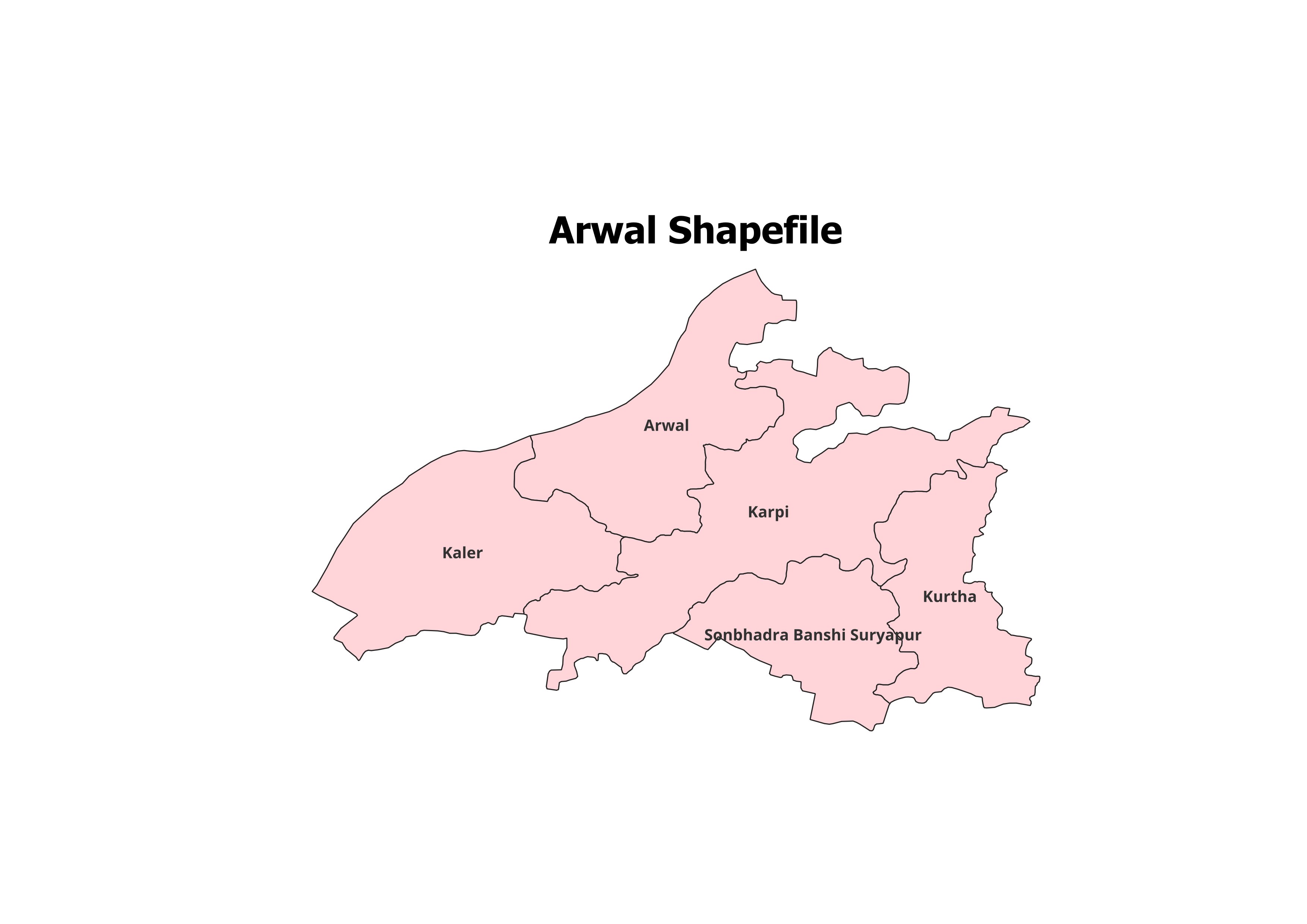
Access precise and comprehensive GIS data of Arwal District with this high-quality shapefile. Covering all 5 Blocks, this dataset is an excellent tool for professionals, researchers, and students engaging in geographic studies or planning projects.
Key Features:
- Complete Block-Level Coverage: Includes all 5 blocks of Arwal District.
- Accurate Data: Ideal for mapping, spatial analysis, and research purposes.
- Ready-to-Use: Fully compatible with popular GIS software such as QGIS and ArcGIS.
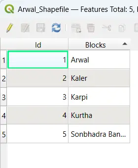
- Detailed Metadata: Includes block names and essential attributes for in-depth analysis.
- File Format: Provided in ESRI Shapefile (.shp) format with all necessary components (.dbf, .shx, .prj).
Applications:
- Research Projects: Suitable for demographic studies, land use analysis, and development planning.
- Educational Use: Perfect for GIS training and academic projects.
- Non-Commercial Purposes: Ideal for personal and academic usage.
Blocks Included in Arwal District:
- Arwal
- Karpi
- Kaler
- Kurtha
- Sonbhadra Banshi Suryapur
Technical Details:
- File Format: ESRI Shapefile (.shp)
- Coordinate System: WGS 84 (EPSG: 4326)
- Resolution: High-quality vector data
- Attributes: Block names, codes, and other metadata
Important Notes:
- Commercial Use: Not Allowed. The shapefile is strictly for academic, research, or personal use.
- Redistribution or Resale: Prohibited under the licensing agreement.
What You’ll Receive:
- Shapefile of Arwal District
- Metadata containing block-level details
- User guide for integrating the shapefile with GIS software
- Complimentary support for troubleshooting and setup
Compatibility:
This shapefile is compatible with:
- QGIS
- ArcGIS
- Global Mapper
- MapInfo
- AutoCAD Map 3D
Licensing:
- For Personal and Academic Use Only
- Redistribution, resale, or commercial use is strictly prohibited.
Sakshi (verified owner) –
The road network shapefiles I purchased worked perfectly for my urban planning project.
Sonal (verified owner) –
I’ve recommended this site to my team. The datasets are consistently accurate and detailed.
Mansi (verified owner) –
Affordable, reliable, and high-quality shapefiles. This site is a hidden gem for GIS professionals.
Riya (verified owner) –
The shapefiles here are top-notch. I’ve recommended this site to all my colleagues.
Simran (verified owner) –
I’ve used many sources for GIS data, but this site stands out for its accuracy and simplicity.
Kunal (verified owner) –
The river network shapefiles were exactly what I needed. Thank you for such high-quality data.
Sonal (verified owner) –
This platform is a lifesaver for GIS professionals. Accurate data at reasonable prices.