


Description
Product Description:
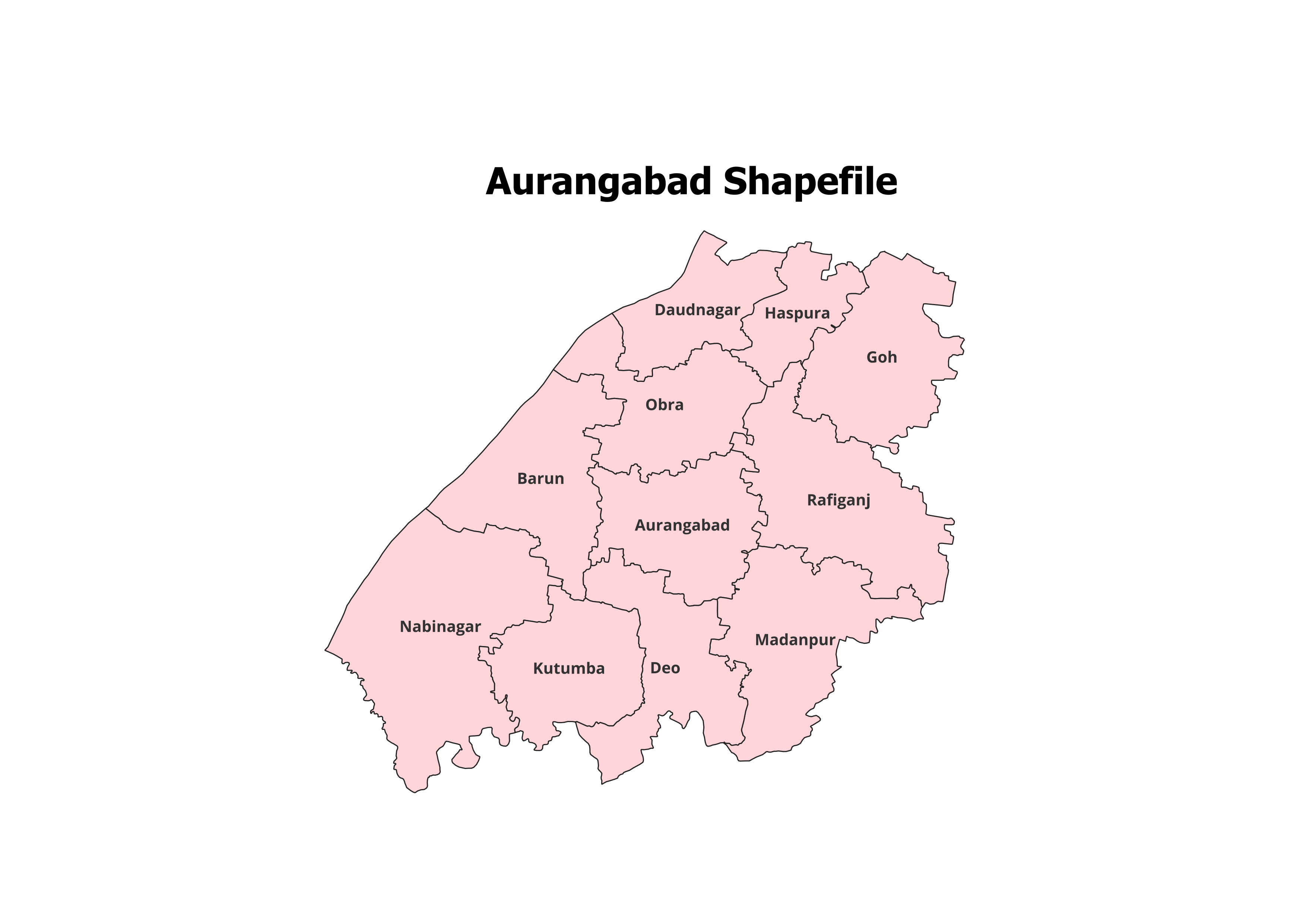
Unlock the geographic potential of Aurangabad District with this accurate and detailed shapefile. Featuring the boundaries of all 11 Blocks, this dataset is a must-have for researchers, planners, and GIS professionals working on spatial analysis or project planning.
Key Features:
- Complete Block-Level Coverage: Includes all 11 blocks of Aurangabad District.
- High-Quality Data: Perfect for mapping, land use planning, and geographic research.
- Easy Integration: Fully compatible with popular GIS software like QGIS and ArcGIS.
- Detailed Attributes: Includes block names and key spatial data for enhanced usability.
- File Format: Delivered in ESRI Shapefile (.shp) format with all necessary components (.dbf, .shx, .prj).
Applications:
- Land Use Planning: Evaluate and plan urban and rural development.
- Academic Research: Ideal for GIS education and analysis projects.
- Non-Commercial Purposes: Suitable for personal and research use.
Blocks Included in Aurangabad District:
- Aurangabad
- Barun
- Kutumba
- Nabinagar
- Goh
- Rafiganj
- Obra
- Daudnagar
- Haspura
- Madanpur
- Deo
Technical Details:
- File Format: ESRI Shapefile (.shp)
- Coordinate System: WGS 84 (EPSG: 4326)
- Resolution: High-precision vector data
- Attributes: Includes block names, codes, and metadata
Important Notes:
- Commercial Use: Not Allowed. This shapefile is intended for academic, research, or personal purposes only.
- Redistribution or Resale: Strictly prohibited under the licensing agreement.
What You’ll Receive:
- Shapefile of Aurangabad District
- Metadata with detailed block-level information
- User guide for GIS software integration
- Free support for troubleshooting and usage
Compatibility:
This shapefile works seamlessly with:
- QGIS
- ArcGIS
- Global Mapper
- MapInfo
- AutoCAD Map 3D
Licensing:
- For Personal and Academic Use Only
- Redistribution, resale, or commercial use is strictly prohibited.
Harsh (verified owner) –
I’ve been using this site for months and the quality of the shapefiles never disappoints.
Anil (verified owner) –
Quick downloads, detailed datasets, and great support. This website is a go-to for GIS data.
Manish (verified owner) –
I’ve been using this site for months and the quality of the shapefiles never disappoints.
Gaurav (verified owner) –
I found rare land-cover datasets here that were perfect for my analysis. Amazing platform.
Priya (verified owner) –
This platform is a lifesaver for GIS professionals. Accurate data at reasonable prices.
Anjali (verified owner) –
I downloaded land-use data and it integrated seamlessly into my GIS software. Perfect.
Karan (verified owner) –
As a GIS analyst, I rely on accurate data. This website has never let me down.