Description
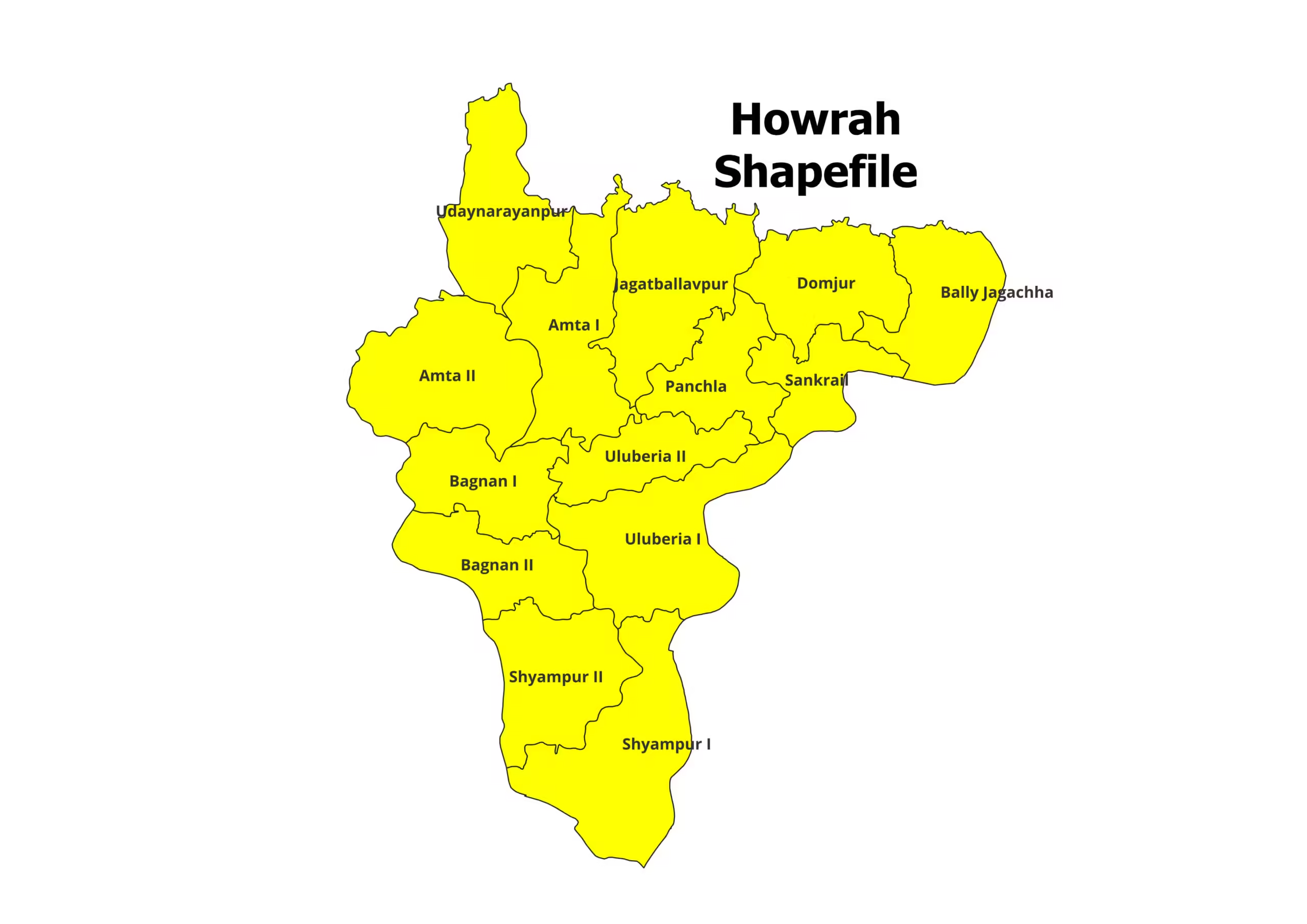
Howrah District Shapefile – Accurate and Comprehensive Geospatial Data
Unlock detailed geospatial insights with the Howrah District Shapefile. Perfectly tailored for GIS professionals, researchers, and urban planners, this shapefile provides precise district and block-level boundaries of Howrah, ensuring seamless integration into your GIS projects.
Key Features:
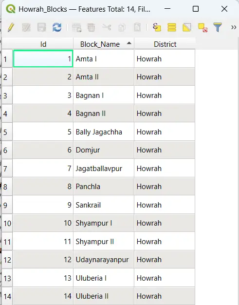
- Comprehensive shapefile of Howrah District, covering all administrative blocks.
- Compatible with GIS software like QGIS, ArcGIS, MapInfo, and others.
- Includes essential file formats (.shp, .dbf, .shx, .prj) for effortless usability.
- Ideal for urban planning, infrastructure development, research, and decision-making.
Steps to Download Howrah District Shapefile:
- Purchase: Add the product to your cart or click “Buy Now” to complete the payment.
- Download: Instantly access the download link after a successful purchase.
- Extract: The shapefile comes in ZIP format. Extract the contents to access files such as .shp, .dbf, .shx, and .prj.
- Start Exploring: Import the shapefile into your GIS software and analyze Howrah District with precision.
Applications:
- Urban Development: Plan and manage urban infrastructure and utilities efficiently.
- Environmental Studies: Analyze land use, water bodies, and ecological patterns.
- Research & Academia: Conduct detailed spatial analysis for academic or policy-driven projects.
- Business Strategy: Optimize location-based services or market expansion strategies.
Why Choose This Shapefile?
- Accuracy Assured: Developed from verified sources for reliability.
- Ready-to-Use: Plug-and-play design ensures quick setup in your projects.
- Versatile Application: Suitable for a wide range of industries and purposes.
Please Note:
- For academic and research purposes only, not intended for commercial use.
- Cite the source in your work: https://geographicalanalysis.com.
For Custom Mapping Services:
- Email us: admin@geographicalanalysis.com
- Visit the Contact Us page: Click here
Disclaimer:
While we provide accurate and up-to-date data, users should verify it for the latest updates and licensing compliance.
Download the Howrah District Shapefile now and take your GIS projects to the next level!


Vikram (verified owner) –
Affordable and high-quality shapefiles. This website has become my go-to source for all my geospatial data needs.
Rhea (verified owner) –
As a freelancer, having access to reliable GIS data is critical. This website has never let me down. The customer service is also outstanding!
Rhea (verified owner) –
I’ve been using this site for over a year, and the consistent quality of the shapefiles keeps me coming back. Fantastic resource for GIS enthusiasts
Sneha (verified owner) –
This website has been a lifesaver for my research work. The shapefiles are accurate and detailed, and the prices are unbeatable
Rhea (verified owner) –
The shapefiles downloaded perfectly and were compatible with multiple GIS platforms. I appreciate the attention to detail in these datasets.
Manish (verified owner) –
Fast, reliable, and affordable. This website ticks all the boxes for anyone needing GIS shapefiles. Will be recommending it to my colleagues.
Aarav (verified owner) –
This website has been a lifesaver for my research work. The shapefiles are accurate and detailed, and the prices are unbeatable
Siddharth (verified owner) –
The detailed shapefiles of state boundaries were exactly what I needed for a client project. I’ll definitely be coming back for more.
Sneha (verified owner) –
I’m impressed with the quality control of the shapefiles. The datasets are clean, accurate, and ready to use. Highly recommend this platform.
Pooja (verified owner) –
The collection here is fantastic! I was surprised to find even rare datasets that are hard to get elsewhere. Great work
Amit (verified owner) –
The topographical shapefiles I purchased were incredibly accurate and helped me complete my mapping project on time. Great service!