

Description
Product Description:
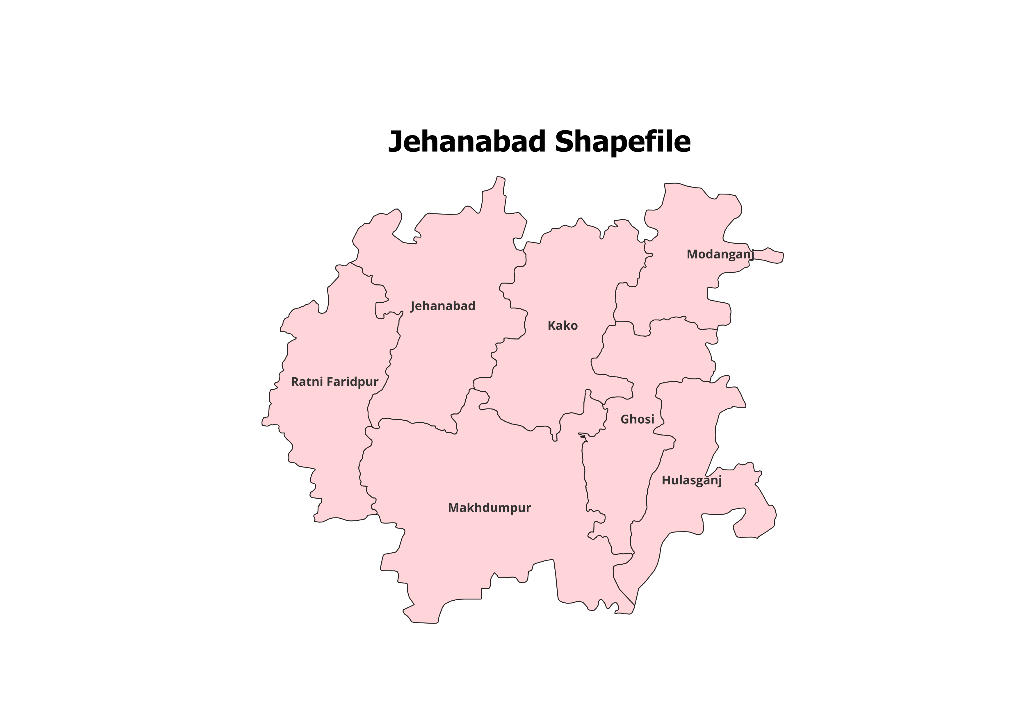
Enhance your geographic research and spatial analysis with the Jehanabad District Shapefile. This dataset includes precise administrative boundaries of all 7 Blocks in the district, making it an invaluable resource for GIS professionals, researchers, and students.
Key Features:
- Comprehensive Block-Level Coverage: Includes all 7 blocks of Jehanabad District.
- High-Accuracy Data: Ideal for mapping, planning, and analytical projects.
- User-Friendly Format: Fully compatible with leading GIS platforms like QGIS and ArcGIS.
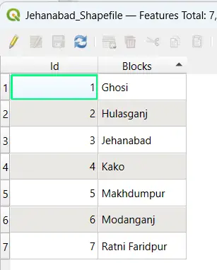
- Detailed Metadata: Includes block names and spatial attributes for accurate analysis.
- File Format: Delivered in ESRI Shapefile (.shp) format with all associated files (.dbf, .shx, .prj).
Applications:
- Urban and Rural Planning: Analyze land use patterns and development prospects.
- Academic Research: Suitable for GIS training and educational projects.
- Non-Commercial Use: Best for research and personal projects.
Blocks Included in Jehanabad District:
- Jehanabad
- Kako
- Ghoshi
- Makhdumpur
- Hulasganj
- Modanganj
- Ratni Faridpur
Technical Details:
- File Format: ESRI Shapefile (.shp)
- Coordinate System: WGS 84 (EPSG: 4326)
- Resolution: High-quality vector data
- Attributes: Block names, codes, and detailed metadata
Important Notes:
- Commercial Use: Not Allowed. This shapefile is intended for academic, research, or personal use only.
- Redistribution or Resale: Strictly prohibited under the licensing agreement.
What You’ll Receive:
- Shapefile of Jehanabad District
- Metadata with block-level details
- Integration guide for GIS platforms
- Free technical support for setup and troubleshooting
Compatibility:
This shapefile is fully compatible with:
- QGIS
- ArcGIS
- Global Mapper
- MapInfo
- AutoCAD Map 3D
Licensing:
- For Personal and Academic Use Only
- Redistribution, resale, or commercial use is strictly prohibited.
Ananya (verified owner) –
Detailed datasets that work perfectly in QGIS. Very happy with my purchase.
Anjali (verified owner) –
The topographic shapefiles I downloaded were spot-on. Excellent quality and accuracy.
Anjali (verified owner) –
This website made my GIS work so much easier. Excellent data quality and great support.
Aarav (verified owner) –
This site saved me so much time with its organized and high-quality datasets. Thank you.
Kajal (verified owner) –
I was impressed by the range of regional shapefiles available here. Found exactly what I needed.
Vikram (verified owner) –
I was surprised by the variety of datasets available. Great platform for GIS professionals and students.
Arjun (verified owner) –
I was surprised by the variety of datasets available. Great platform for GIS professionals and students.