


Description
Product Description:
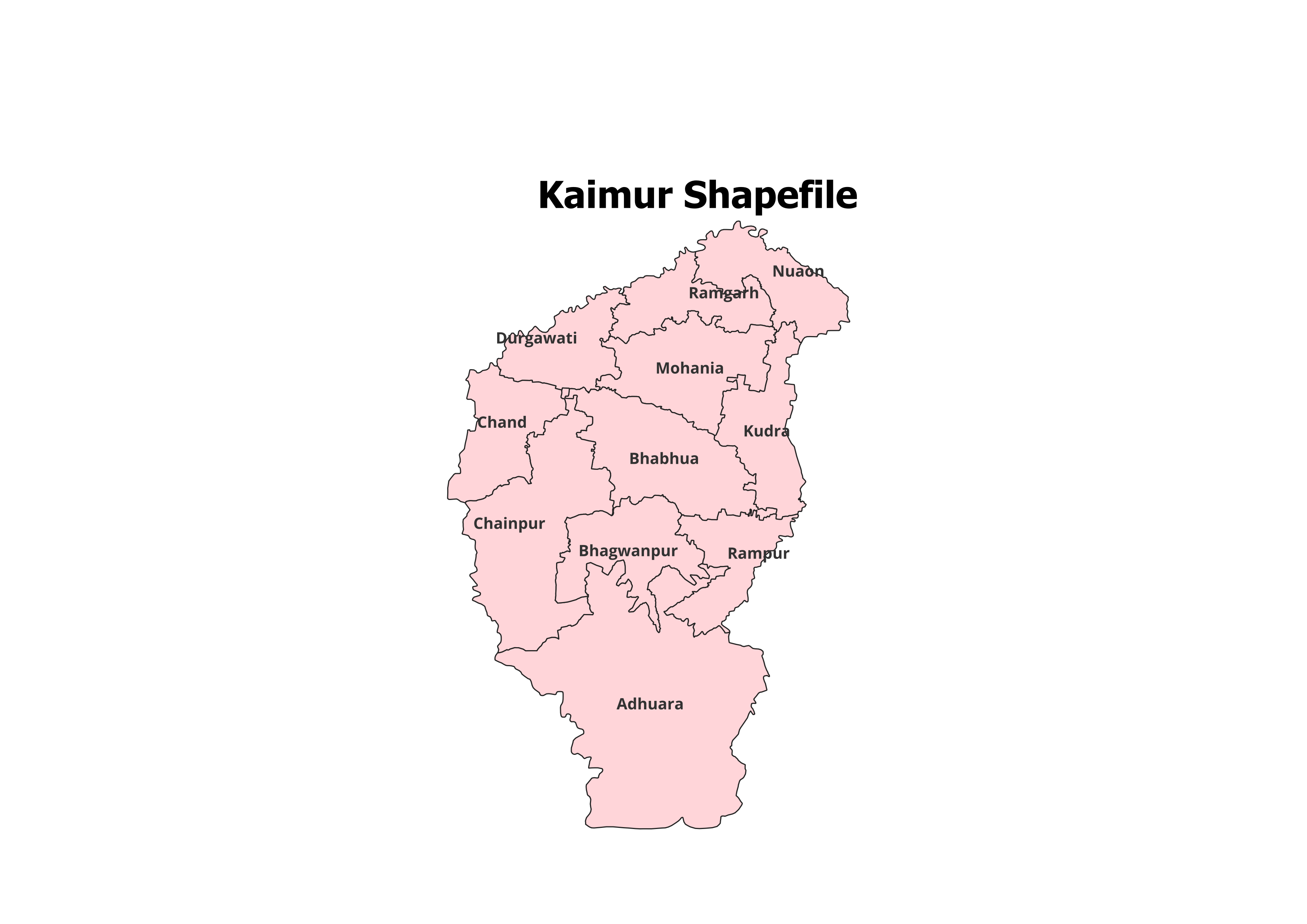
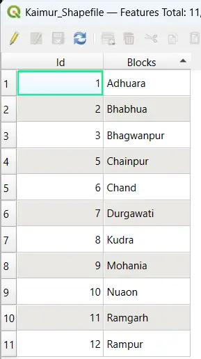
Discover the geographic details of Kaimur District with our professionally curated shapefile. This dataset encompasses the administrative boundaries and 11 Blocks of Kaimur District, making it an indispensable tool for GIS professionals, researchers, and students.
Key Features:
- Complete Block-Level Details: Covers all 11 blocks of Kaimur District.
- Accurate and Reliable Data: Perfect for GIS analysis, research, and visualization.
- Ready-to-Use Format: Fully compatible with QGIS, ArcGIS, and other GIS software.
- Rich Metadata: Includes block names and essential spatial attributes for detailed mapping.
- File Format: Delivered as an ESRI Shapefile (.shp) with all required components (.dbf, .shx, .prj).
Applications:
- Research Studies: Ideal for land use planning, resource management, and demographic studies.
- Educational Use: Perfect for GIS training and project work.
- Non-Commercial Projects: Suited for personal and academic purposes.
Blocks Included in Kaimur District:
- Adhaura
- Bhabua
- Bhagwanpur
- Chainpur
- Durgawati
- Kudra
- Mohania
- Nuaon
- Ramgarh
- Rampur
- Chand
Technical Details:
- File Format: ESRI Shapefile (.shp)
- Coordinate System: WGS 84 (EPSG: 4326)
- Resolution: High-quality vector data
- Attributes: Block names, codes, and detailed metadata
Important Notes:
- Commercial Use: Not Allowed. The shapefile is strictly for academic, research, or personal use.
- Redistribution or Resale: Prohibited under the licensing agreement.
What You’ll Receive:
- Shapefile of Kaimur District
- Metadata with block-level details
- Step-by-step guide for GIS integration
- Complimentary technical support for troubleshooting
Compatibility:
This shapefile works seamlessly with major GIS tools, including:
- QGIS
- ArcGIS
- Global Mapper
- MapInfo
- AutoCAD Map 3D
Licensing:
- For Personal and Academic Use Only
- Redistribution, resale, or commercial use is strictly prohibited.
Deepak (verified owner) –
I’ve been using this site for months and the quality of the shapefiles never disappoints.
Simran (verified owner) –
The detailed administrative boundary shapefiles were exactly what I needed. Thanks.
Aryan (verified owner) –
This website offers incredible value. The shapefiles are clean, accurate, and easy to work with.
Varun (verified owner) –
Great collection of shapefiles. I’ll definitely recommend this site to my colleagues.
Pranav (verified owner) –
I found rare land-cover datasets here that were perfect for my analysis. Amazing platform.
Swati (verified owner) –
Amazing accuracy and great metadata. This site is a lifesaver for GIS enthusiasts.
Nisha (verified owner) –
Highly detailed shapefiles at affordable prices. This site never disappoints.