Are you ready to explore the power of GIS and map data? ArcGIS Online is a robust platform that can help you do just that. This blog will cover everything you need to know to get started with ArcGIS Online, including its benefits, how to create and share maps, and tutorials and resources for learning more. So let’s get started!
What is ArcGIS Online?
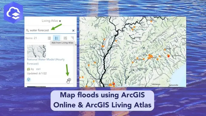
Esri, a leader in geographic information systems (GIS), made ArcGIS Online, a platform that runs in the cloud. It gives you easy-to-use tools to make maps, share them, and look at data about them. It helps organizations visualize their data, create interactive web maps, and collaborate on projects. With ArcGIS Online, you can make maps, analyze data, and share your findings with coworkers, customers, and other important people.
ArcGIS Online is an excellent tool for many fields, such as business, education, and government. It can create web maps, analyze data, and develop applications. It can also create interactive online maps and share them with others.
Click Here to Show the story
Benefits of ArcGIS Online
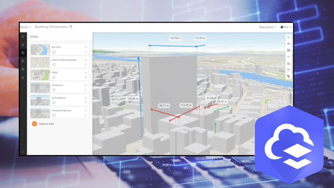
There are many benefits to using ArcGIS Online. It has powerful tools and features that can help you make and share maps, analyze data, and work on projects with others. Here are some of the biggest reasons to use ArcGIS Online:
- Easy to use: ArcGIS Online is designed to be easy to use, so you can quickly get started creating and sharing maps.
- Cost-effective: ArcGIS Online is a cost-effective solution for organizations looking to leverage the power of GIS without investing in costly software.
- Collaboration: ArcGIS Online enables you to collaborate on projects and share insights with colleagues, customers, and stakeholders.
- Flexibility: ArcGIS Online is highly customizable so that you can create interactive maps tailored to your needs.
Getting Started with ArcGIS Online

Getting started with ArcGIS Online is easy. Signing up for an account is all you need to do to start exploring the platform. Here’s how to get started:
- Set up an ArcGIS Online account: Before using ArcGIS Online, you must set up an account. You can visit the ArcGIS Online website and sign up for an account.
- Explore the platform: Once you have an account, you can explore and get familiar with the different features and tools available.
- Create a map: Once you have a basic understanding of the platform, you can create maps. You can create interactive maps that display points, lines, and polygons. You can also add layers and customize the look and feel of your map.
- Share your map: After creating it, you can share it with others. You can share your map publicly or with specific people.
Creating and Sharing Maps with ArcGIS Online
Creating and sharing a map with ArcGIS Online is easy. Here’s how to do it:
- Create a new map: You can create a new map by selecting the “Create a New Map” option from the ArcGIS Online homepage.
- Add layers: You can add layers to your map, such as points, lines, and polygons. You can also add data from existing sources, such as shapefiles, CSV files, and KML files.
- Change the look and feel: You can change the colour scheme, text size, and zoom level of your maps to change how they look and feel.
- Share your map. You can let other people see your map by choosing “Share” from the menu bar. You can choose to share your map publicly or with specific people.
Exploring Data Sets with ArcGIS Online
ArcGIS Online is an excellent tool for exploring data sets. You can import data from existing sources, such as shapefiles, CSV files, and KML files. Adding points, lines, and polygons can also create data sets.
Once you have a data set, you can explore it in ArcGIS Online. You can use the tools and features to analyze the data, make visuals, and make maps that people can interact with. You can also use the platform to work with your colleagues and share your ideas with stakeholders.
Analyzing Data and Creating Reports with ArcGIS Online
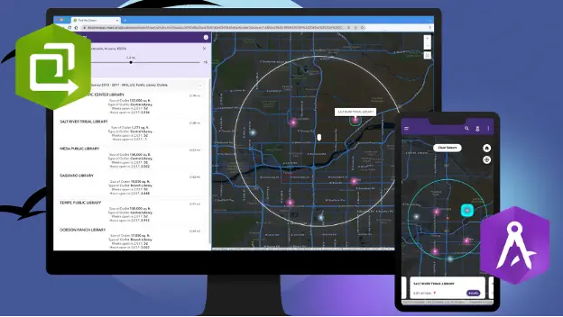
ArcGIS Online is an excellent tool for analyzing data and creating reports. You can use the platform to explore data sets, create visualizations, and analyze data. You can also create and share reports with colleagues, customers, and stakeholders.
You can use various tools and features on the platform to help you analyze data and make reports. You can use the tools, for example, to explore data sets, make visualizations, and make reports. You can also use the platform to collaborate on projects and share insights with colleagues.
Collaborating and Sharing Maps with ArcGIS Online
ArcGIS Online is an excellent tool for collaborating and sharing maps. You can use the platform to share maps with colleagues, customers, and stakeholders. You can also use the platform to collaborate on projects and share insights with colleagues.
The platform has several tools and features that can help you share maps and work together. You can use the tools, for example, to explore data sets, make visualizations, and make reports. You can also use the platform to share maps with specific people or make them publicly available.
Advanced ArcGIS Online Features
ArcGIS Online is an excellent tool for advanced mapping and analysis. It gives you various tools and features to help you make maps, share them, analyze data, and work on projects together.
The platform has several advanced GIS tools, such as geocoding, buffering, and spatial analysis. You can use these tools to create interactive maps, analyze data, and generate reports. You can also use the platform to collaborate on projects and share insights with colleagues.
Tutorials and Resources for Learning ArcGIS Online
Are you interested in learning more about ArcGIS Online? There are several tutorials and resources available to help you get started. Here are some of the best tutorials and resources for learning ArcGIS Online:
- Esri’s ArcGIS Online Learning Center: The ArcGIS Online Learning Center provides a range of tutorials and resources to help you get started with ArcGIS Online.
- ArcGIS Online Tutorials: Several online tutorials can help you get started with ArcGIS Online.
- YouTube Tutorials: There are also a lot of lessons on YouTube that might assist you in learning how to use ArcGIS Online.
- Esri’s Support Center: Esri’s Support Center provides a range of tutorials and resources to help you get started with ArcGIS Online.
ArcGIS Online Tools and Resources
Are you looking for additional tools and resources in ArcGIS Online? You can use various tools and resources to look at data sets, make interactive maps, and work on projects with others. Here are some of the essential tools and resources for ArcGIS Online:
- Esri’s ArcGIS Online App: The ArcGIS Online App has various tools and capabilities to assist you in creating and sharing maps, analysing data, and collaborating on projects.
- Esri’s ArcGIS Marketplace: The ArcGIS Marketplace provides tools and resources to help you explore data sets, create interactive maps, and collaborate on projects.
- Esri’s ArcGIS Developer Platform: The ArcGIS Developer Platform includes various tools and resources to assist you in developing custom applications and workflows.
Best Practices for Using ArcGIS Online
Are you looking for tips and best practices for using ArcGIS Online? Here are the essential tips and best practices for the platform:
- Use the tools and features: ArcGIS Online offers a variety of tools and features to assist you in creating and sharing maps, analysing data, and collaborating on projects. Take advantage of these tools and features to get the most out of the platform.
- Explore data sets: ArcGIS Online is an excellent tool for exploring data sets. Make sure to explore data sets to gain insights into your data and uncover new trends.
- Share insights: ArcGIS Online provides various tools and features to help you collaborate on projects and share insights with colleagues, customers, and stakeholders. Make sure to use these tools to share insights and collaborate on projects.
- Stay organized: ArcGIS Online is a powerful platform, but it can be overwhelming. Stay organised and keep track of your projects to get the most output of the platform.
Commonly Asked Questions about ArcGIS Online
Are you looking for answers to commonly asked questions about ArcGIS Online? Here are some answers to frequently asked ArcGIS Online questions:
Q: What is ArcGIS Online?
Answer: Esri, which is a leader in geographic information systems (GIS), made ArcGIS Online, which is a cloud-based platform. It gives you easy-to-use tools to make maps, share them, and look at data about them.
Q: What can I do with ArcGIS Online?
Answer: You can use ArcGIS Online to create maps, analyze data, and collaborate on projects. You can also use the platform to create interactive online maps and share them with others.
Q: Is ArcGIS Online free?
Answer: ArcGIS Online is a cheap way for businesses to use the power of GIS without having to buy expensive software.
Setting up an ArcGIS Online account
Are you ready to get started with ArcGIS Online? Setting up an ArcGIS Online account is easy. First, go to the ArcGIS Online website and create an account. After you’ve signed up, you can explore the platform and get familiar with the different features and tools available.
Conclusion
ArcGIS Online is a robust platform that can help you create, share, and analyze data related to maps and geography. It provides easy-to-use tools to create interactive maps, collaborate on projects, and share insights with colleagues, customers, and stakeholders. In this blog, we’ve covered everything you need to know to get started with ArcGIS Online, including its benefits, how to create and share maps, and tutorials and resources for learning more. Now that you know the basics of ArcGIS Online, it’s time to start!
Are you ready to discover the power of GIS and explore mapping data? Sign up for an ArcGIS Online account today and start exploring the platform. ArcGIS Online allows you to create maps, analyze data, and share insights with colleagues, customers, and stakeholders. Unlock the power of GIS and start exploring mapping data with ArcGIS Online today!
Recent Stories:
[web_stories title=”false” excerpt=”false” author=”false” date=”false” archive_link=”true” archive_link_label=”” circle_size=”150″ sharp_corners=”false” image_alignment=”left” number_of_columns=”1″ number_of_stories=”5″ order=”DESC” orderby=”post_date” view=”circles” /]

