Are you ready to embark on a journey of exploration and discovery? In today’s modern world, the ability to read and understand maps is a valuable skill that can open up a world of opportunities. Whether you’re planning a hiking trip in the wilderness, navigating through unfamiliar city streets, or simply gaining a better understanding of the world around you, having strong map reading and geographic skills is essential. This comprehensive guide will provide you with the knowledge and tools you need to confidently navigate any terrain, avoid potential dangers, and fully appreciate the beauty and complexity of our planet’s geographic features.
Key Takeaways:
- Understanding Coordinates: Learning to read and interpret coordinates is essential in map reading and geographic navigation. It provides a way to pinpoint exact locations on a map.
- Map Scale: Understanding map scale is crucial in determining distances and the relative size of features on a map. It helps in planning routes and estimating travel time.
- Orienting a Map: Knowing how to properly orient a map is vital for accurate navigation. Using compass directions or landmarks can help ensure the map aligns with the real-world terrain.
Understanding Maps
Clearly, understanding maps is essential for navigating the world. Whether you are planning a trip, studying geography, or simply trying to find your way around a new city, map reading skills are crucial.
Types of Maps and Their Uses
One of the first things to understand about maps is the various types and their specific uses. Some common types of maps include topographic maps for displaying elevation, road maps for navigation, and political maps for showing boundaries and countries. Each type serves a different purpose, and it is important to choose the right map for your specific needs. Any skilled navigator should be familiar with the different types of maps and how to effectively use them.
| Types of Maps | Uses |
| Topographic maps | Display elevation |
| Road maps | Navigation |
| Political maps | Show boundaries and countries |
Map Elements: Scale, Symbols, and Legends
One important aspect of maps is the inclusion of scale, symbols, and legends. The scale indicates the relationship between the distances on the map and the actual distances on the ground. Symbols are used to represent various features such as roads, rivers, and landmarks. Legends provide a key to understanding the symbols and other features on the map. Understanding these elements is crucial for interpreting and using maps effectively.
This understanding is particularly important when it comes to navigating unfamiliar terrain or interpreting detailed maps. It allows for accurate distance measurements, clear representation of features, and efficient use of navigational aids. The map elements of scale, symbols, and legends are essential tools for any map reader.
Techniques for Effective Map Reading
After understanding the basic components of a map, it’s essential to learn effective techniques for accurate map reading. By honing these skills, individuals can confidently navigate through the world using maps as their guide.
Orienting the Map
To effectively navigate with a map, it’s crucial to orient the map in the direction you are facing. This involves aligning the map’s features with the surrounding landscape. To do this, find a prominent landmark or use a compass to determine the general direction. Then, rotate the map until the features correspond with the actual layout of the land.
Determining Position and Distance
An important aspect of map reading is determining one’s position and estimating distances accurately. Understanding how to interpret map symbols, scales, and contour lines is crucial for this. By identifying key landmarks, such as rivers, mountains, or roads, and utilizing the map’s scale, individuals can accurately gauge their position and calculate distances to various destinations.
Orienting the map and determining position and distance are essential aspects of effective map reading. By practicing these techniques and familiarizing oneself with map symbols and scales, individuals can confidently navigate their surroundings and accurately interpret the information presented on the map. These skills are invaluable for both outdoor enthusiasts and professionals who rely on geographic knowledge for their work.
Advanced Geographic Skills
To further enhance your geographical skills, it is important to understand and master advanced techniques. These skills will allow you to navigate more effectively and efficiently in various terrains and environments. Below are some advanced geographic skills that will help you become a more adept map reader and navigator:
- Topographic map reading
- Using technology in modern map reading
The ability to read and interpret topographic maps is a crucial skill for anyone venturing into unfamiliar or challenging landscapes. The detailed information provided by topographic maps, such as elevation contours, hydrographic features, and vegetation, allows navigators to plan routes and understand the terrain in great detail. Familiarizing yourself with topographic map symbols and scales will enable you to accurately interpret these maps and navigate with confidence, even in the most rugged and remote locations.
Using Technology in Modern Map Reading
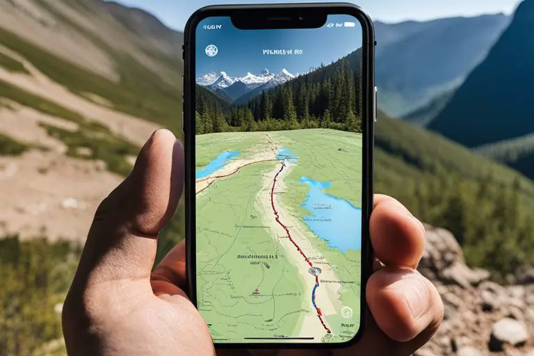
With advancements in technology, map reading has been revolutionized. An array of digital tools, including GPS devices, online mapping applications, and mobile navigation apps, have made it easier than ever to navigate and access detailed geographic information. These tools provide real-time location data, route planning capabilities, and access to a vast array of geospatial data. Using these technologies can greatly enhance your ability to navigate and explore unfamiliar territories, making your adventures safer and more efficient.
Topographic and GPS devices have become invaluable resources for modern-day explorers, providing accurate positioning, detailed topographic maps, and real-time navigation assistance. Embracing these technological tools can significantly improve your map reading and navigational skills, offering a wealth of information and convenience at your fingertips.
Applying Map Skills in Real-World Scenarios
For those seeking to apply their map reading and geographic skills in real-world situations, there are numerous opportunities to put your knowledge to the test. Whether you are planning outdoor adventures or navigating urban environments, the ability to read and interpret maps is an essential skill.
Planning Outdoor Adventures
Any outdoor enthusiast knows the importance of being able to navigate the wilderness with confidence. Whether you are hiking, camping, or embarking on a backcountry excursion, understanding how to read a map can be the difference between a successful adventure and getting lost. By honing your map reading skills and familiarizing yourself with basic land navigation techniques, you can ensure that you are always prepared for whatever the great outdoors throws at you.
Adventures in urban environments also present unique navigation challenges. From navigating bustling city streets to finding your way through complex public transportation systems, urban settings require a different set of map reading skills. Understanding how to interpret city maps, navigate public transportation routes, and find your way through crowded streets is essential for anyone looking to explore a new city or simply find their way around their own neighborhood. It is important to develop these skills to confidently navigate urban environments and make the most of your travels.
It is crucial for outdoor enthusiasts and city dwellers alike to master the art of map reading and geographic skills in order to navigate both natural and urban landscapes with confidence and efficiency. By honing these skills, individuals can ensure their safety, enhance their exploration, and uncover new opportunities in the world around them.
Conclusion
So, as we conclude this guide to map reading and geographic skills, it is clear that these abilities are crucial in navigating and understanding the world around us. Developing these skills not only allows us to interpret and utilize maps effectively, but also deepens our comprehension of the earth’s landscapes and the interconnectedness of different regions. Whether it’s for travel, outdoor exploration, or simply gaining a greater understanding of our planet, map reading and geographic skills are invaluable tools that can enrich our lives. With practice and dedication, anyone can master these skills and confidently navigate the world.
FAQ
Q: Why is map reading important in today’s world?
A: Map reading is crucial for understanding and navigating the world around us. It helps us make informed decisions about travel, find our way in unfamiliar places, and understand the geographical features of the places we visit. In today’s technology-driven world, map reading skills are still essential, as GPS and navigation apps may not always be available or reliable.
Q: What are some basic map reading skills?
A: Basic map reading skills include understanding symbols and legends, interpreting scale and distance, orienting the map to the landscape, and using coordinates to pinpoint locations. Additionally, compass navigation and understanding contour lines for elevation are valuable skills for more advanced map readers.
Q: How can I improve my map reading skills?
A: Improving map reading skills takes practice and exposure to different types of maps. Start by familiarizing yourself with the symbols and legends commonly used on maps. Take time to study and understand the scale and coordinate systems. Additionally, consider taking a course or workshop on map reading and navigation, and spend time outdoors using maps to navigate real-world environments. With consistent practice and learning, your map reading skills will improve.