
Description
Product Description:
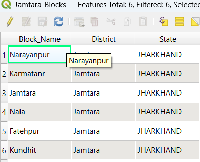
Gain access to a comprehensive and precise shapefile of Jamtara District, Jharkhand, featuring all 6 Blocks. Designed for GIS professionals, researchers, planners, students, and development-sector users, this dataset is ideal for detailed spatial analysis, mapping, planning, and project development.
Key Features:
Complete Block-Level Data: Covers all 6 blocks of Jamtara District.
Accurate and Reliable: High-quality vector data for effective mapping and spatial analysis.
User-Friendly: Compatible with leading GIS platforms like QGIS and ArcGIS.
Rich Metadata: Includes block names and essential spatial attributes.
File Format: Delivered in ESRI Shapefile format with associated files such as .shp, .dbf, .shx, and .prj.
Applications:
Urban and Rural Development: Plan and analyze development projects efficiently.
Educational and Research Projects: Perfect for GIS training, academic work, and spatial research.
Planning and Survey Work: Useful for block-level mapping, field planning, and administrative analysis.
Non-Commercial Use: Tailored for personal, academic, and research purposes.
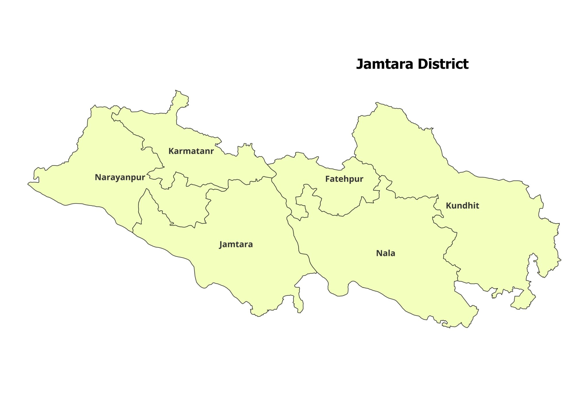
Blocks Included in Jamtara District:
Jamtara
Kundhit
Nala
Narayanpur
Karmatand / Karmatanr
Fatehpur
The official Jamtara district website lists 6 development blocks in the district: Kundhit, Nala, Jamtara, Narayanpur, Karmatanr, and Fatehpur. (Jamtara District)
Technical Details:
File Format: ESRI Shapefile .shp
Coordinate System: WGS 84, EPSG: 4326
Resolution: High-precision vector data
Attributes: Includes block names, codes, and metadata
Important Notes:
Commercial Use: Not Allowed. This dataset is intended for academic, research, or personal use only.
Redistribution or Resale: Strictly prohibited under the licensing agreement.
What You’ll Receive:
Shapefile of Jamtara District
Metadata with block-level information
Step-by-step guide for GIS integration
Free technical support for setup and troubleshooting
Compatibility:
This shapefile is fully compatible with:
QGIS
ArcGIS
Global Mapper
MapInfo
AutoCAD Map 3D
Licensing:
For Personal and Academic Use Only.
Redistribution, resale, or commercial use is strictly prohibited.
Reviews
There are no reviews yet.