

Description
Product Description:
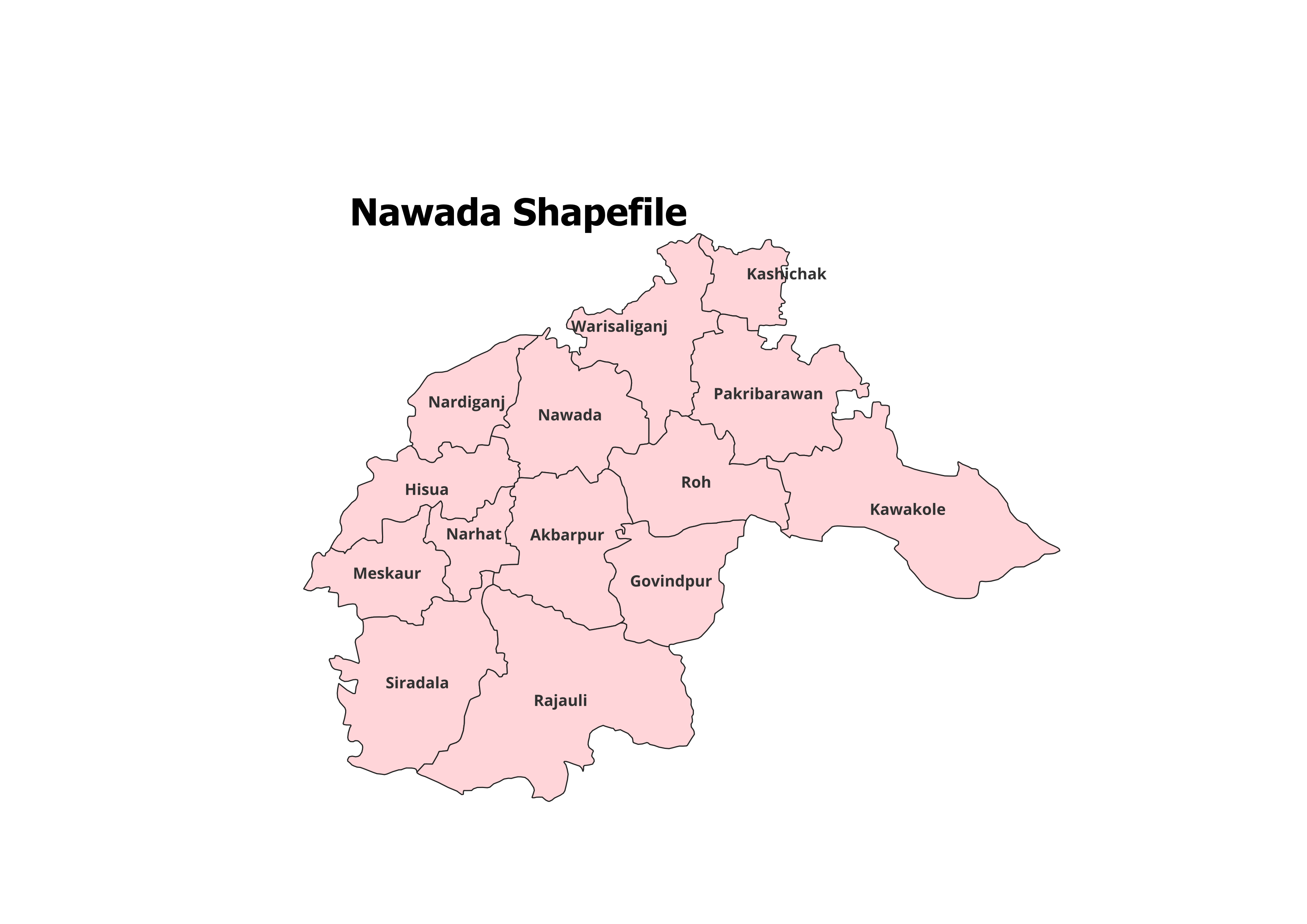
Uncover the geographic layout of Nawada District with our comprehensive shapefile. This GIS dataset includes the complete administrative boundaries of Nawada District and its 14 Blocks, making it an essential tool for researchers, students, and GIS professionals.
Key Features:
- Complete Block-Level Coverage: Includes all 14 blocks within Nawada District.
- Accurate and Verified: Sourced from reliable records, ensuring precision for research and academic projects.
- GIS-Ready Format: Designed for easy use with software like QGIS, ArcGIS, and more.
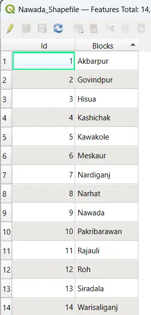
- Detailed Attributes: Block names and codes are included for enhanced usability.
- File Format: ESRI Shapefile (.shp) with accompanying files (.dbf, .shx, .prj).
Applications:
- Research Projects: Analyze demographic patterns, land use, and environmental trends.
- Educational Work: Ideal for projects, reports, and presentations in academia.
- Non-Commercial Use: Perfect for creating custom maps and performing spatial analyses.
Blocks Included in Nawada District:
- Akbarpur
- Kawakol
- Nardiganj
- Hisua
- Narhat
- Pakribarawan
- Rajauli
- Roh
- Sirdala
- Warisaliganj
- Meskaur
- Nawada
- Kasichak
- Govindpur
Technical Details:
- File Format: ESRI Shapefile (.shp)
- Coordinate System: WGS 84 (EPSG: 4326)
- Resolution: High-quality vector data
- Attributes: Includes block names, codes, and other metadata
Important Notes:
- Commercial Use: Not Allowed. This shapefile is intended for academic, research, or personal use only.
- Redistribution or Resale: Strictly prohibited.
What You’ll Receive:
- Shapefile of Nawada District
- Metadata with block-specific attributes
- Step-by-step usage instructions
- Technical support for setup and integration
Compatibility:
Works seamlessly with:
- QGIS
- ArcGIS
- Global Mapper
- MapInfo
- AutoCAD Map 3D
Licensing:
- Personal and Academic Use Only
- Redistribution, resale, or commercial use is strictly prohibited.
Download Now and Begin Your Spatial Analysis of Nawada District!
Neha (verified owner) –
It’s hard to find such accurate and reliable GIS datasets online. This site is a gem.
Sakshi (verified owner) –
I was surprised by the variety of datasets available. Great platform for GIS professionals and students.
Pranav (verified owner) –
I purchased a district boundary shapefile and it worked flawlessly in my software. Great job.
Shruti (verified owner) –
I’m impressed by the simplicity and accuracy of the data here. Fantastic resource for GIS professionals.
Meera (verified owner) –
This site saved me so much time with its organized and high-quality datasets. Thank you.
Kajal (verified owner) –
Excellent customer service and top-notch datasets. Highly recommend this website.
Akash (verified owner) –
Found rare datasets here that I couldn’t locate anywhere else. Great platform for GIS data.