


Description
Product Description:
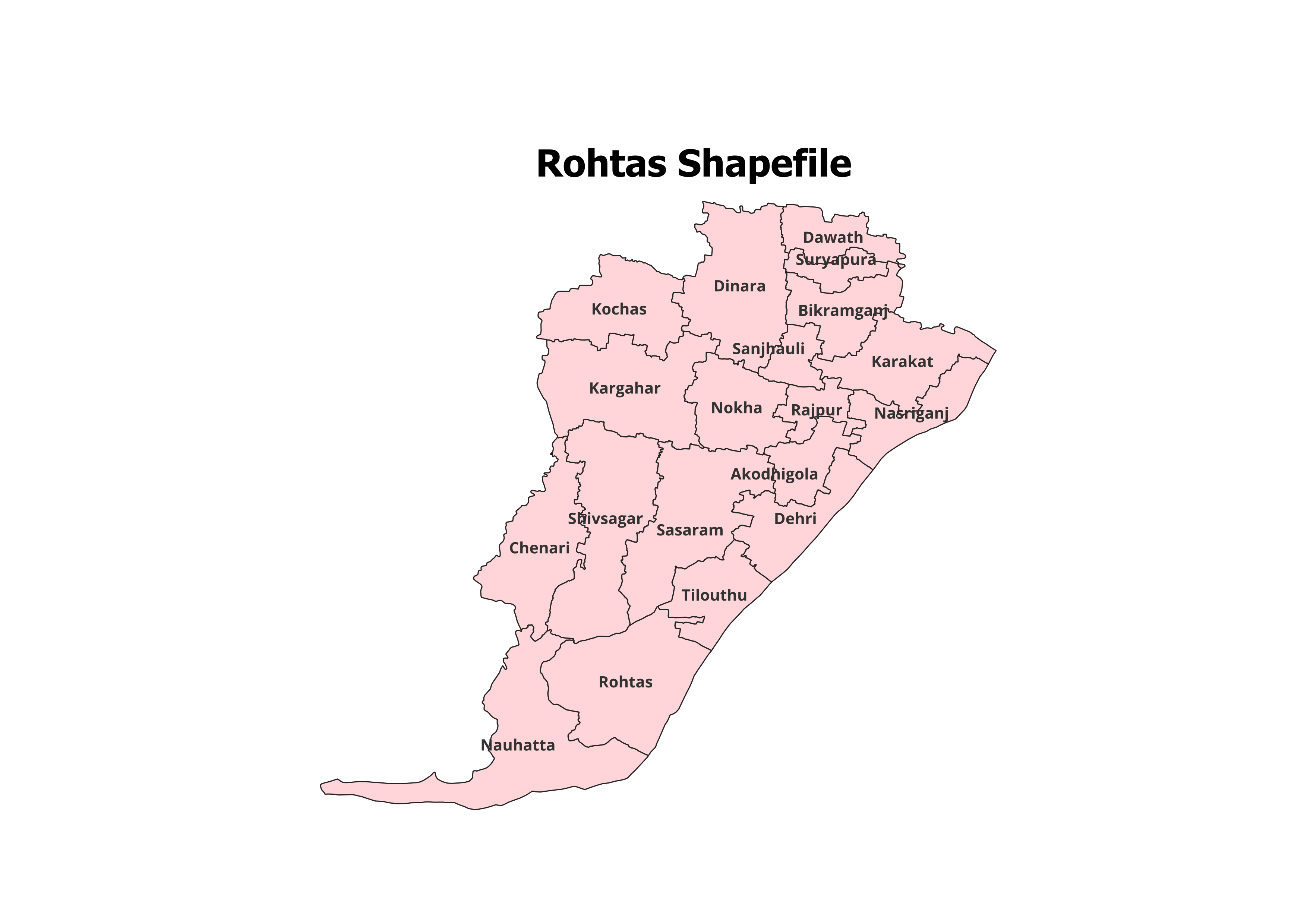
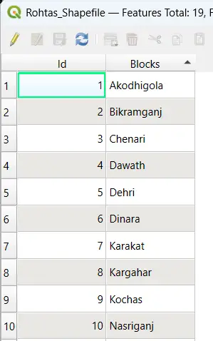
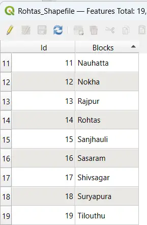
Explore the detailed administrative boundaries of Rohtas District with our high-precision shapefile. This dataset features comprehensive geographic information for 19 Blocks, making it a valuable resource for GIS professionals, researchers, and academic projects.
Key Features:
- Complete Block-Level Coverage: Includes all 19 blocks of Rohtas District.
- High Accuracy: Perfect for mapping, spatial analysis, and demographic studies.
- GIS-Ready: Fully compatible with QGIS, ArcGIS, and other GIS platforms.
- Rich Metadata: Provides block names and essential spatial attributes.
- File Format: Delivered in ESRI Shapefile (.shp) format with supporting files (.dbf, .shx, .prj).
Applications:
- Research and Planning: Suitable for land use planning, resource management, and policy-making.
- Educational Use: An excellent resource for GIS learning and project development.
- Non-Commercial Purposes: Best suited for academic and personal projects.
Blocks Included in Rohtas District:
- Akorhi Gola
- Bikramganj
- Chenari
- Dawath
- Dehri
- Dinara
- Karakat
- Kochas
- Nauhatta
- Nokha
- Rajpur
- Rohtas
- Sanjhauli
- Sasaram
- Shivsagar
- Tilouthu
- Tilauthu
- Nasriganj
- Sheosagar
Technical Details:
- File Format: ESRI Shapefile (.shp)
- Coordinate System: WGS 84 (EPSG: 4326)
- Resolution: High-quality vector data
- Attributes: Block names, codes, and metadata
Important Notes:
- Commercial Use: Not Allowed. This dataset is intended for academic, research, or personal use only.
- Redistribution or Resale: Prohibited under the licensing agreement.
What You’ll Receive:
- Shapefile of Rohtas District
- Metadata with block-level details
- Step-by-step guide for GIS software integration
- Free technical support for setup and troubleshooting
Compatibility:
Compatible with popular GIS platforms, including:
- QGIS
- ArcGIS
- Global Mapper
- MapInfo
- AutoCAD Map 3D
Licensing:
- For Personal and Academic Use Only
- Redistribution, resale, or commercial use is strictly prohibited.

Riya (verified owner) –
The shapefiles here are worth every penny. Great resource for anyone working with GIS.
Swati (verified owner) –
I appreciate the clear descriptions and compatibility notes provided for each dataset.
Yash (verified owner) –
The shapefiles here are top-notch. I’ve recommended this site to all my colleagues.
Gaurav (verified owner) –
The river network shapefiles were exactly what I needed. Thank you for such high-quality data.
Meera (verified owner) –
The hydrology shapefiles I downloaded were precise and easy to integrate. Great resource.
Rahul (verified owner) –
This platform is a lifesaver for GIS professionals. Accurate data at reasonable prices.
Jatin (verified owner) –
The boundary shapefiles were incredibly accurate. Will definitely use this site again.