

Description
Product Description:
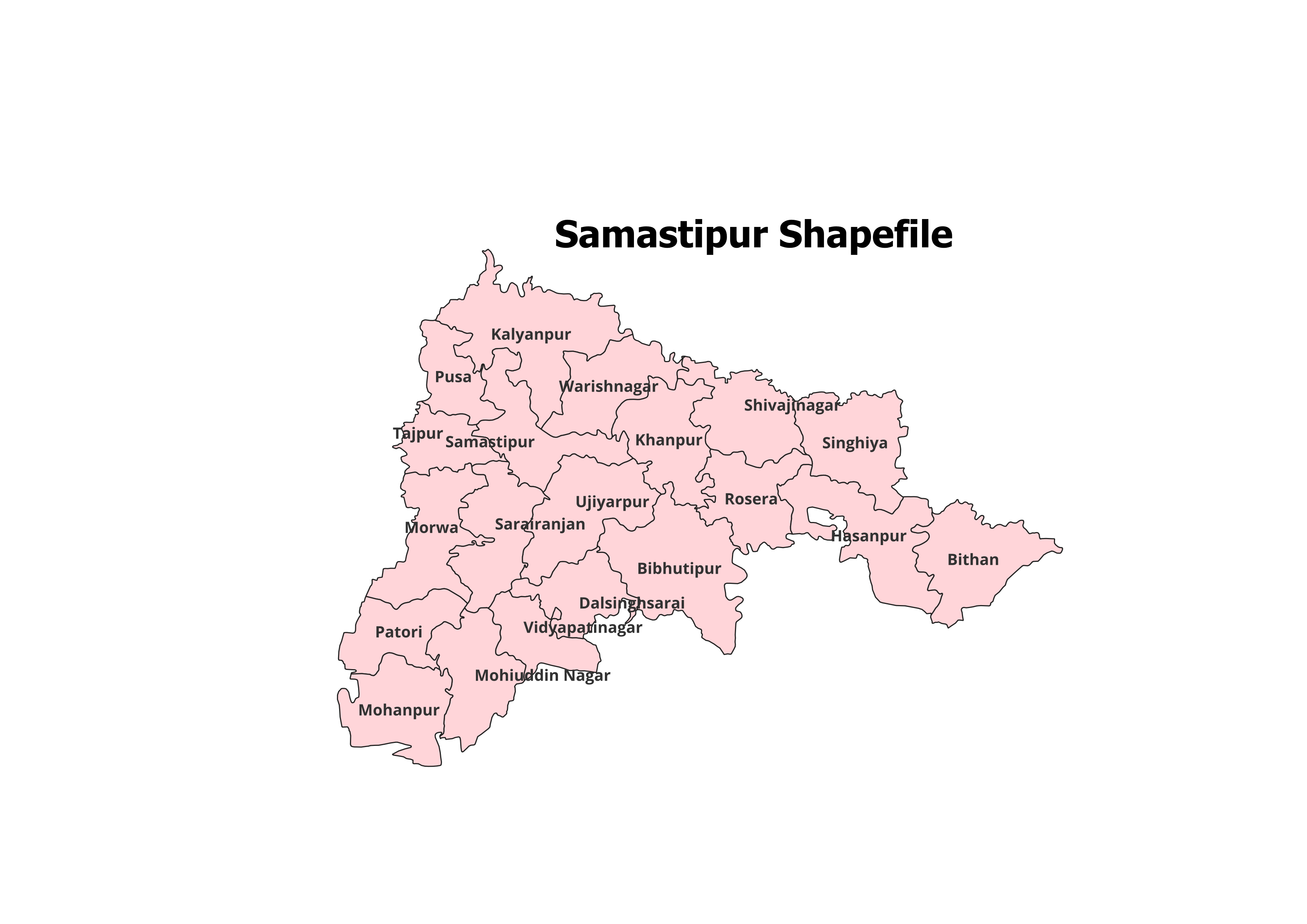
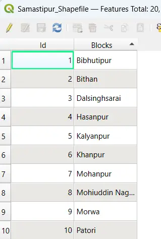
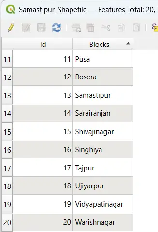
Explore the detailed geographic structure of Samastipur District with our premium shapefile. This dataset features the administrative boundaries of Samastipur District and its 20 Blocks, tailored for GIS professionals, researchers, and students.
Key Features:
- Complete Block-Level Coverage: Includes all 20 blocks of Samastipur District.
- Accurate and Verified Data: Perfect for academic, research, and personal projects.
- GIS-Ready Format: Compatible with leading GIS tools like QGIS, ArcGIS, and more.
- Detailed Attributes: Contains block names and codes for efficient analysis.
- File Format: ESRI Shapefile (.shp) with all necessary supplementary files (.dbf, .shx, .prj).
Applications:
- Research Studies: Ideal for analyzing land use, population trends, and spatial planning.
- Academic Projects: Essential for GIS mapping, presentations, and geographical research.
- Non-Commercial Use: Best suited for personal and educational purposes.
Blocks Included in Samastipur District:
- Bibhutipur
- Dalsinghsarai
- Hasanpur
- Kalyanpur
- Khanpur
- Mohanpur
- Patori
- Pusa
- Rosera
- Sarairanjan
- Shivaji Nagar
- Singhia
- Tajpur
- Ujiarpur
- Vidyapati Nagar
- Warisnagar
- Samastipur
- Morwa
- Bithan
- Bakhri
Technical Details:
- File Format: ESRI Shapefile (.shp)
- Coordinate System: WGS 84 (EPSG: 4326)
- Resolution: High-quality vector data
- Attributes: Includes block names, codes, and metadata
Important Notes:
- Commercial Use: Not Allowed. This shapefile is intended for academic, research, or personal use only.
- Redistribution or Resale: Strictly prohibited.
What You’ll Receive:
- Shapefile of Samastipur District
- Metadata with block-level attributes
- Easy setup instructions for GIS integration
- Free technical support for troubleshooting and usage
Compatibility:
Compatible with popular GIS tools, including:
- QGIS
- ArcGIS
- Global Mapper
- MapInfo
- AutoCAD Map 3D
Licensing:
- Personal and Academic Use Only
- Redistribution, resale, or commercial use is strictly prohibited.
Sonal (verified owner) –
I’ve recommended this site to my team. The datasets are consistently accurate and detailed.
Pooja (verified owner) –
The hydrology shapefiles I downloaded were precise and easy to integrate. Great resource.
Nisha (verified owner) –
I’ve used many sources for GIS data, but this site stands out for its accuracy and simplicity.
Mansi (verified owner) –
Highly detailed shapefiles at affordable prices. This site never disappoints.
Priya (verified owner) –
The topographic shapefiles I downloaded were spot-on. Excellent quality and accuracy.
Jatin (verified owner) –
The road network shapefiles I purchased worked perfectly for my urban planning project.
Deepika (verified owner) –
I was surprised by the variety of datasets available. Great platform for GIS professionals and students.