Description
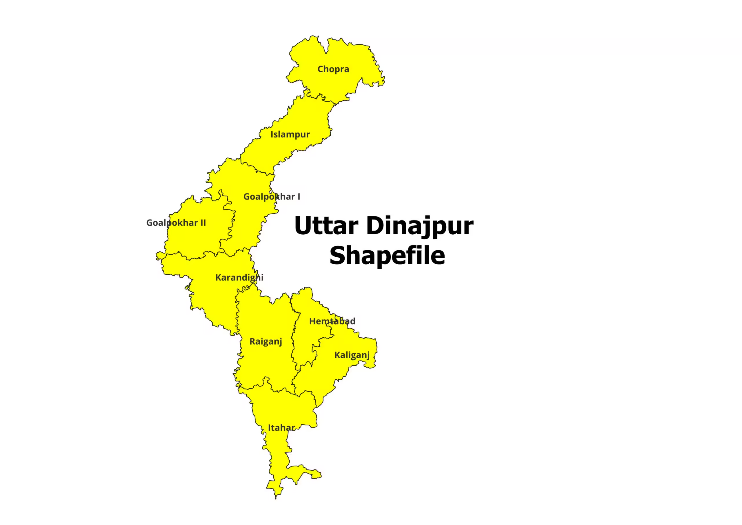
Uttar Dinajpur District Shapefile – Comprehensive Geospatial Data for GIS Applications
Unlock detailed geospatial insights with the Uttar Dinajpur District Shapefile, tailored for researchers, planners, and GIS enthusiasts. This shapefile offers precise district and block-level boundaries of Uttar Dinajpur, making it an invaluable resource for spatial analysis, planning, and academic projects.
Key Features:
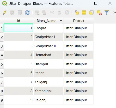
- Detailed shapefile covering all administrative blocks of Uttar Dinajpur District.
- Fully compatible with popular GIS software, including QGIS, ArcGIS, and MapInfo.
- Standard file formats (.shp, .dbf, .shx, .prj) for seamless integration.
- Suitable for urban and rural planning, environmental studies, demographic analysis, and more.
Steps to Download Uttar Dinajpur Shapefile:
- Purchase: Click “Add to Cart” or “Buy Now” to proceed with the payment.
- Download: Gain instant access to the download link after successful payment.
- Extract: The shapefile is provided in ZIP format. Extract the contents to access files like .shp, .dbf, and .shx.
- Start Exploring: Import the shapefile into your GIS software and begin detailed analysis.
Applications:
- Academic Research: Study demographic patterns, land use, and geographic trends.
- Planning & Development: Ideal for resource allocation, infrastructure planning, and environmental assessments.
- Policy Making: Use for creating district-level development strategies.
- Business Analysis: Optimize operations and services with precise geographical insights.
Please Note:
- This shapefile is intended for academic and research purposes only and not for commercial use.
- When using this shapefile, please cite the source: https://geographicalanalysis.com.
For Custom Mapping Services:
- Email us: admin@geographicalanalysis.com
- Visit the Contact Us page: Click here
Disclaimer:
We strive to provide accurate data, but users are encouraged to verify the information and adhere to licensing terms.
Rohit (verified owner) –
I was looking for ecological shapefiles for a conservation project, and I found everything I needed here. The datasets are of exceptional quality.
Pooja (verified owner) –
The navigation on this site is simple, and the download process is hassle-free. I found my dataset in no time!
Sneha (verified owner) –
The topographical shapefiles I purchased were incredibly accurate and helped me complete my mapping project on time. Great service!
Rohan (verified owner) –
I’m impressed with the quality control of the shapefiles. The datasets are clean, accurate, and ready to use. Highly recommend this platform.
Priya (verified owner) –
The detailed shapefiles of state boundaries were exactly what I needed for a client project. I’ll definitely be coming back for more.
Amit (verified owner) –
The collection here is fantastic! I was surprised to find even rare datasets that are hard to get elsewhere. Great work
Siddharth (verified owner) –
The river network shapefiles I downloaded were flawless. They integrated seamlessly with my GIS software. Great job, team.
Ishita (verified owner) –
The river network shapefiles I downloaded were flawless. They integrated seamlessly with my GIS software. Great job, team.
Aarav (verified owner) –
The detailed shapefiles of state boundaries were exactly what I needed for a client project. I’ll definitely be coming back for more.
Priya (verified owner) –
I’ve purchased shapefiles from many sources, but none compare to the precision and clarity of the data here. Definitely worth the investment!
Pooja (verified owner) –
Affordable and high-quality shapefiles. This website has become my go-to source for all my geospatial data needs.