
Rain Water Harvesting Components: Sustainable Solution for Water Management
Rain water harvesting is a way to save water and make it easier for cities to keep up with water…
Read More
Rain water harvesting is a way to save water and make it easier for cities to keep up with water…
Read More
Subsistence Agriculture and Commercial Agriculture; Characteristics, Advantages and Disadvantages. Subsistence Agriculture: Subsistence agriculture is characterized as the sort of agriculture that is worried about…
Read More
Solar, Wind Energy, Hydroelectric, Biomass, Hydrogen, Geothermal, and Tides. These are the most important types of Renewable Energy, Sustainable Power Sources. Most…
Read More
Nepal is one of the most beautiful countries. These beautiful countries face frequent earthquakes. Science Behind the Cause of Earthquake…
Read More
The causes of overpopulation are complex and influenced by many factors like economic, cultural, religious and individual issues. Overpopulation is not good. Overpopulation:…
Read More
Water pollution is now one of the major problems for our Society. Minimize Water Pollution and Improve the Environment. Reduce Water Pollution and Improve the…
Read More
Mediterranean Climate is described by mellow wet winters and warm to sweltering, dry summers. Characteristics of a Mediterranean Climate are very interesting….
Read More
Air pollution, Soil Pollution, Air pollution, Water pollution, Soil pollution, Noise pollution, Radioactive, Thermal, Heat, and Light pollution. These are pollution…
Read More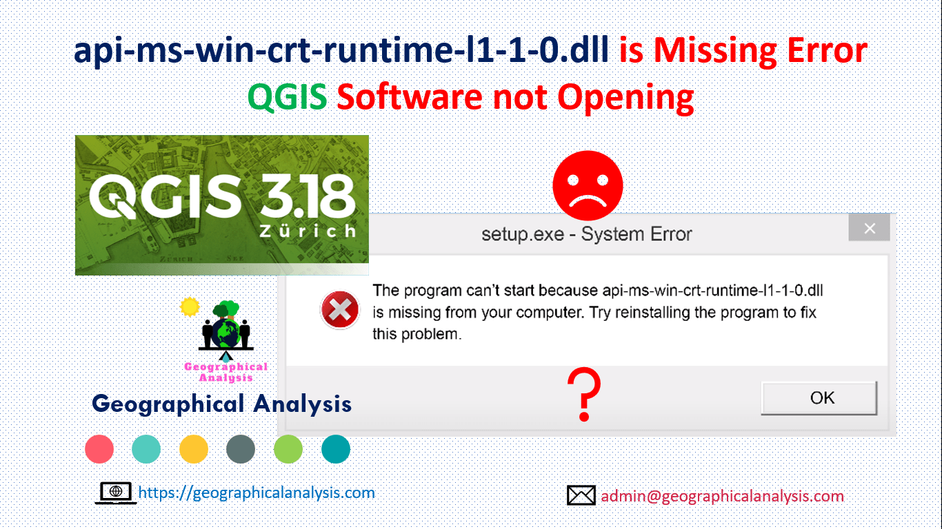
The program can’t start because api-ms-win-crt-runtime-l1-1-0.dll is missing from your computer. This error show when opening qgis software. Follow this…
Read More
Unsupervised classification is done on software analysis. It uses computer techniques to determine the pixels which are related and group…
Read MoreOur main motive is to share some valuable information and knowledge about various Geographical Phenomenon. Day by day we will cover more topics as possible.