The map of the United States outlines the distinct regions that make up the country, including the Northeast, Southeast, Midwest, Southwest, and West. Each region boasts its own unique characteristics, from the bustling cities of the Northeast to the sun-soaked beaches of the Southeast. The map also showcases the 50 states, providing an overview of their boundaries and spatial arrangement.
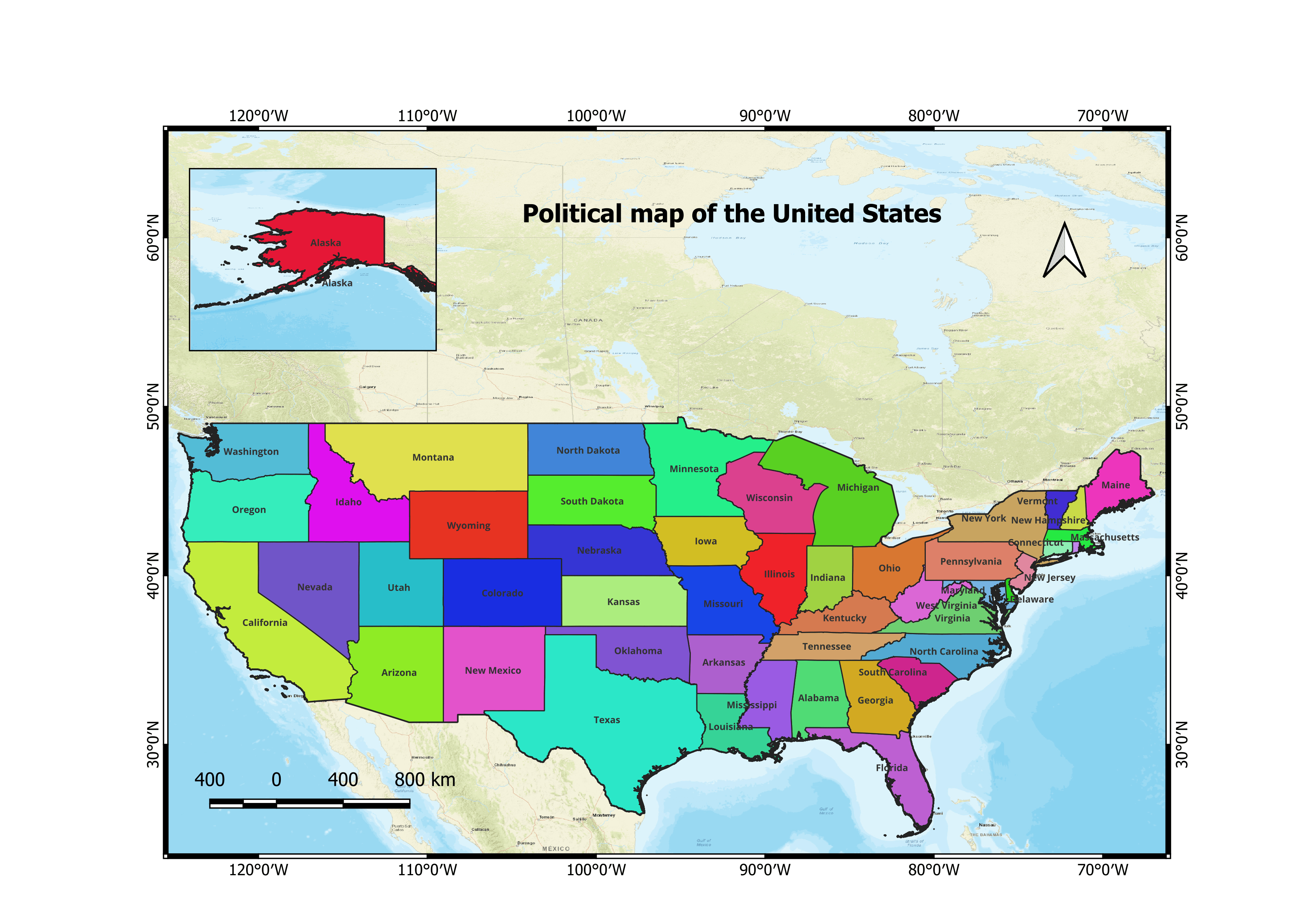
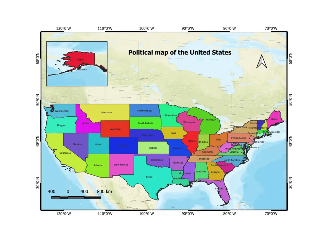
1. Political Map of the United States
The United States of America is a federal republic composed of 50 states. Here are the names of all 50 states:
- Alabama
- Alaska
- Arizona
- Arkansas
- California
- Colorado
- Connecticut
- Delaware
- Florida
- Georgia
- Hawaii
- Idaho
- Illinois
- Indiana
- Iowa
- Kansas
- Kentucky
- Louisiana
- Maine
- Maryland
- Massachusetts
- Michigan
- Minnesota
- Mississippi
- Missouri
- Montana
- Nebraska
- Nevada
- New Hampshire
- New Jersey
- New Mexico
- New York
- North Carolina
- North Dakota
- Ohio
- Oklahoma
- Oregon
- Pennsylvania
- Rhode Island
- South Carolina
- South Dakota
- Tennessee
- Texas
- Utah
- Vermont
- Virginia
- Washington
- West Virginia
- Wisconsin
- Wyoming
These states collectively form the United States of America, each with its distinct identity, government, and role within the federal system.
Download the political map of the united states with state names.
Learn about the Geography of the United States.
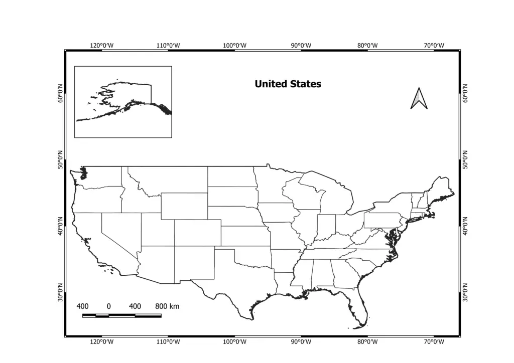
2. Blank map of the United States
A blank map of the United States serves as a valuable educational resource for learning about the country’s geography. It allows students to test their knowledge by labeling states, major cities, rivers, mountain ranges, and other physical features. Through this interactive process, learners gain a deeper understanding of the nation’s geography, improving their spatial awareness and knowledge retention.
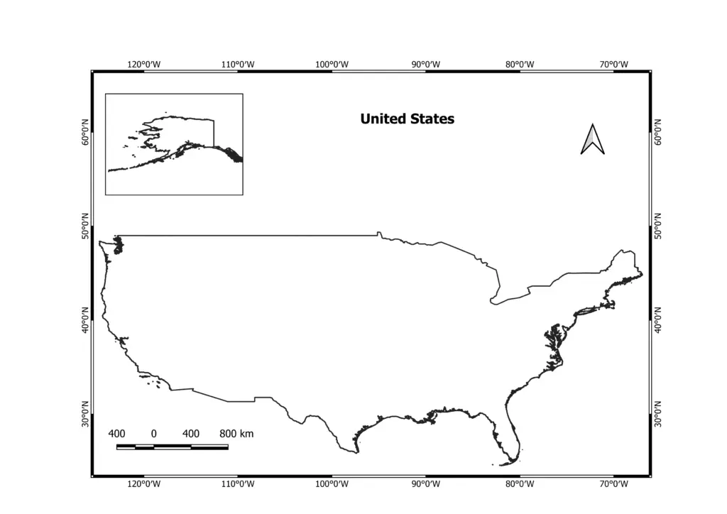
3. Outline map of the United States
The purpose of an outline map is to provide a simplified visual representation of a geographic area, such as the United States, by depicting its boundaries, major features, and essential elements. Outline maps serve several important purposes.
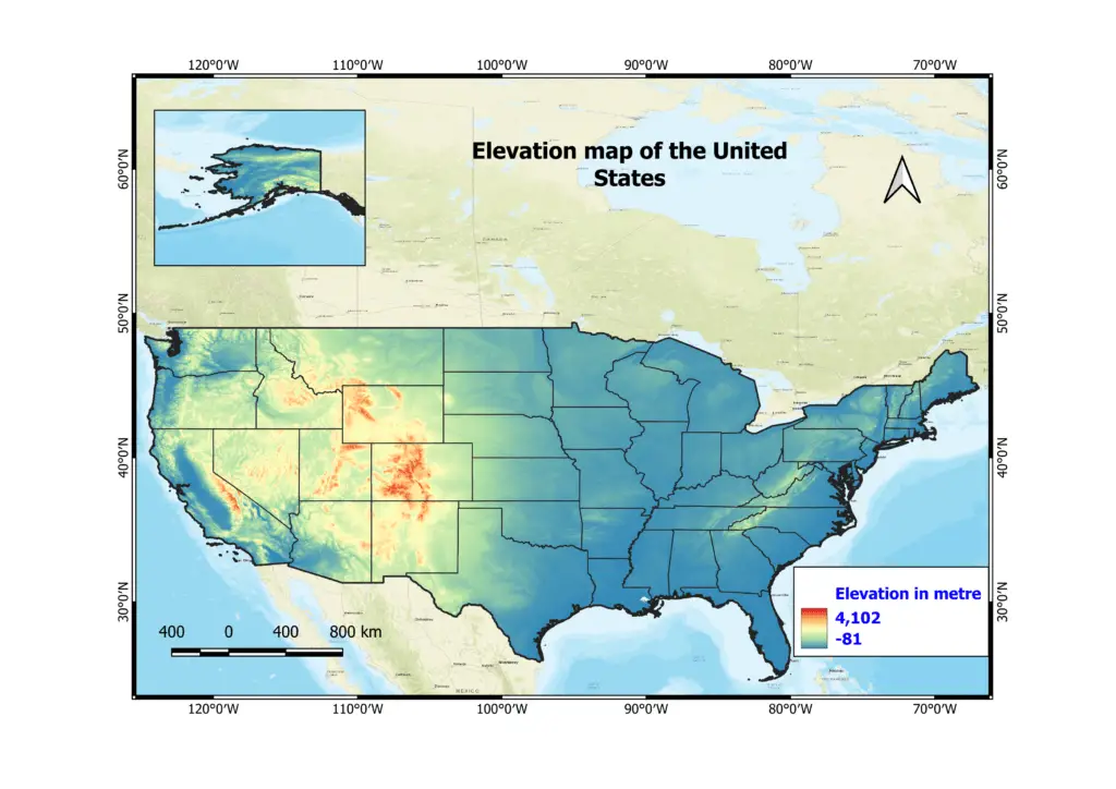
4. Elevation map of the United States
The elevation map of the United States offers a detailed representation of the country’s diverse topography, highlighting the variations in land elevation across different regions. This article aims to delve into the significance of the elevation map, providing insights into the country’s major mountain ranges, highland regions, and coastal areas. By understanding the elevation map, we can appreciate the geological diversity and natural beauty of the United States
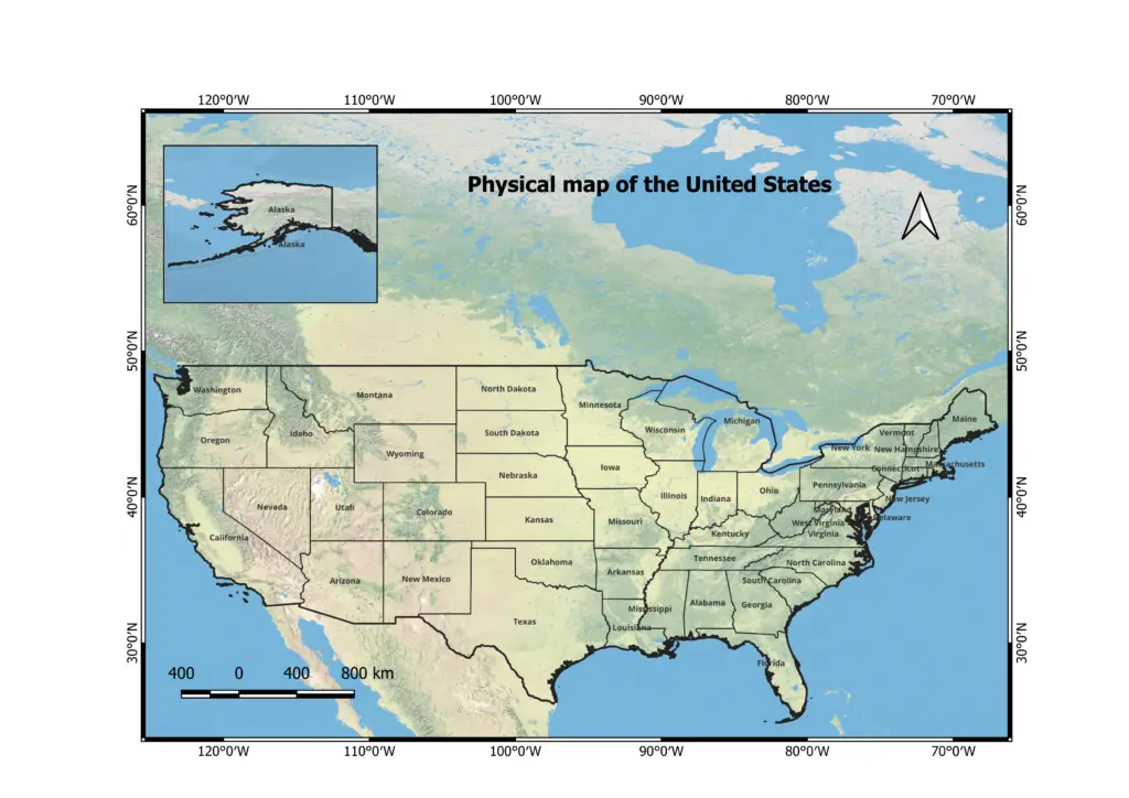
5. Physical map of the United States
The physical map of the United States provides a comprehensive visual representation of the country’s diverse geographical features. From towering mountain ranges to expansive plains, sprawling coastlines to winding rivers, the physical map offers a glimpse into the nation’s natural beauty. This article aims to delve into the significance of the physical map, highlighting key elements of the United States geography and their importance.
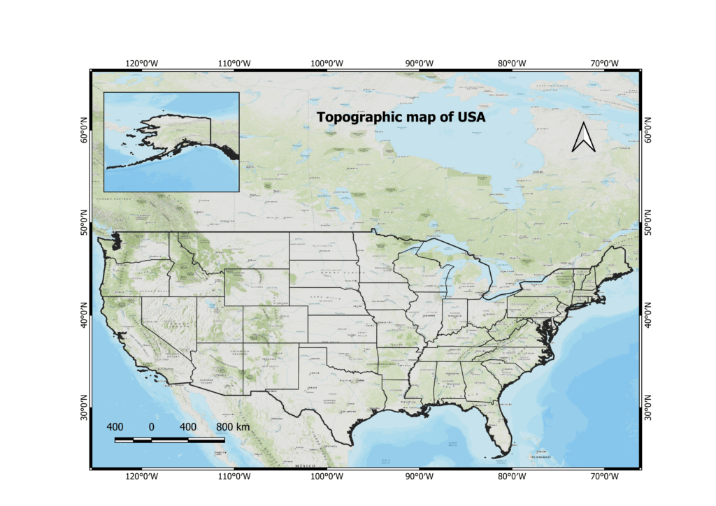
6. Topographic map of USA
The topographic map of the United States provides a detailed representation of the country’s landforms, elevations, and contours. By using contour lines, the topographic map offers insights into the varying terrain and physical features of different regions. This article aims to delve into the significance of the topographic map, highlighting key elements of the United States’ topography and its importance.
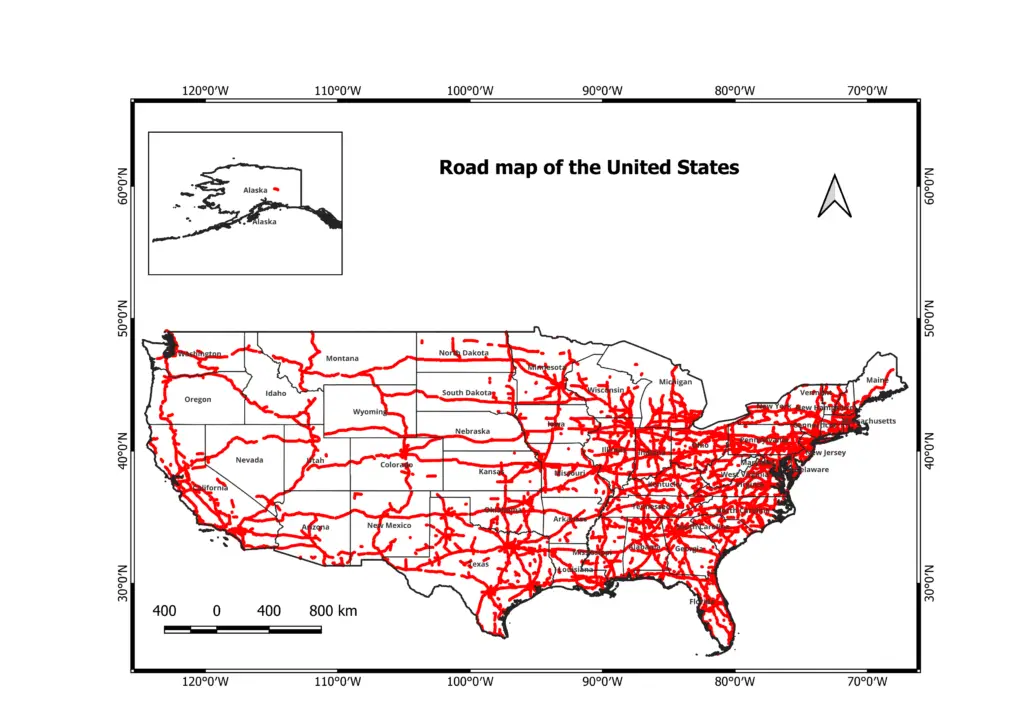
7. Road map of the United States
The road map of the United States provides a comprehensive guide to navigating the nation’s vast network of highways, interstates, and roads. It offers valuable information on routes, cities, intersections, and points of interest. This article aims to delve into the significance of the road map, highlighting key elements of the United States’ road infrastructure and its importance for travel and transportation.
8. Water Bodies Map of the United States

9. Land use and land cover map of the United States

Conclusion
The map of the United States is a valuable tool that provides a comprehensive visual representation of the nation’s geography, political divisions, topography, and transportation networks. It offers a glimpse into the diverse and vast landscape of the country, showcasing its mountain ranges, coastal areas, plains, rivers, and major cities.
The map serves multiple purposes, including education, navigation, research, and planning. It aids in understanding the spatial relationships between states, regions, and landmarks, allowing for a deeper appreciation of the country’s physical and cultural diversity. Whether used in classrooms, for travel planning, or for exploring the natural wonders of the nation, the map of the United States plays a vital role in broadening our knowledge and understanding of this vast country.
All maps are created on QGIS, an open-sourced GIS software.