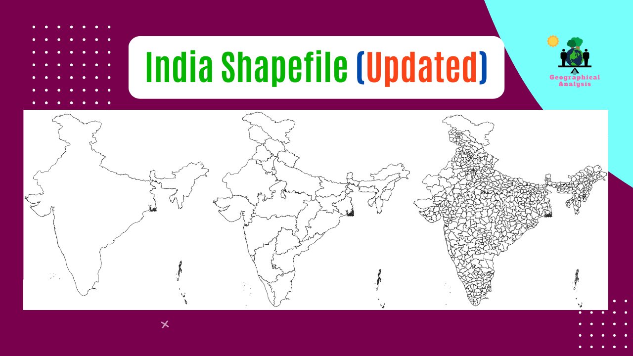
Three types of shapefiles are available here.
- India boundary shapefile
- India shapefile with all states
- India district level Shapefiles
Visit our Product Page:
At the moment, India consists of 28 states and 8 union territories. Jammu and Ladakh, Dadar and Nagar Haveli and Daman and Diu were also included in the Shapefile as recently developed regions.

Visit our Product Page:
As of Now, India comprises a total of 806 districts. Download shapefile including all these districts.


West Bengal District Shapefiles free download (updated)
Download shapefile of West Bengal along with all districts
Here is a list of all the states in India along with their respective capitals:
- Andhra Pradesh – Amaravati
- Arunachal Pradesh – Itanagar
- Assam – Dispur
- Bihar – Patna
- Chhattisgarh – Raipur
- Goa – Panaji
- Gujarat – Gandhinagar
- Haryana – Chandigarh (shared with Punjab)
- Himachal Pradesh – Shimla
- Jharkhand – Ranchi
- Karnataka – Bengaluru (Bangalore)
- Kerala – Thiruvananthapuram
- Madhya Pradesh – Bhopal
- Maharashtra – Mumbai
- Manipur – Imphal
- Meghalaya – Shillong
- Mizoram – Aizawl
- Nagaland – Kohima
- Odisha – Bhubaneswar
- Punjab – Chandigarh (shared with Haryana)
- Rajasthan – Jaipur
- Sikkim – Gangtok
- Tamil Nadu – Chennai
- Telangana – Hyderabad
- Tripura – Agartala
- Uttar Pradesh – Lucknow
- Uttarakhand – Dehradun
- West Bengal – Kolkata
Additionally, India has 8 union territories with their capitals:
- Andaman and Nicobar Islands – Port Blair
- Chandigarh – Chandigarh
- Dadra and Nagar Haveli and Daman and Diu – Daman
- Lakshadweep – Kavaratti
- Delhi (National Capital Territory of Delhi) – New Delhi
- Puducherry – Puducherry
- Ladakh – Leh
- Jammu and Kashmir – Srinagar (summer capital), Jammu (winter capital)
It’s important to note that the capital cities mentioned above are administrative centers and hold significant political and cultural importance in their respective states or union territories.
N.B. Shapefiles are shared for educational purposes only.