

Description
Product Description:
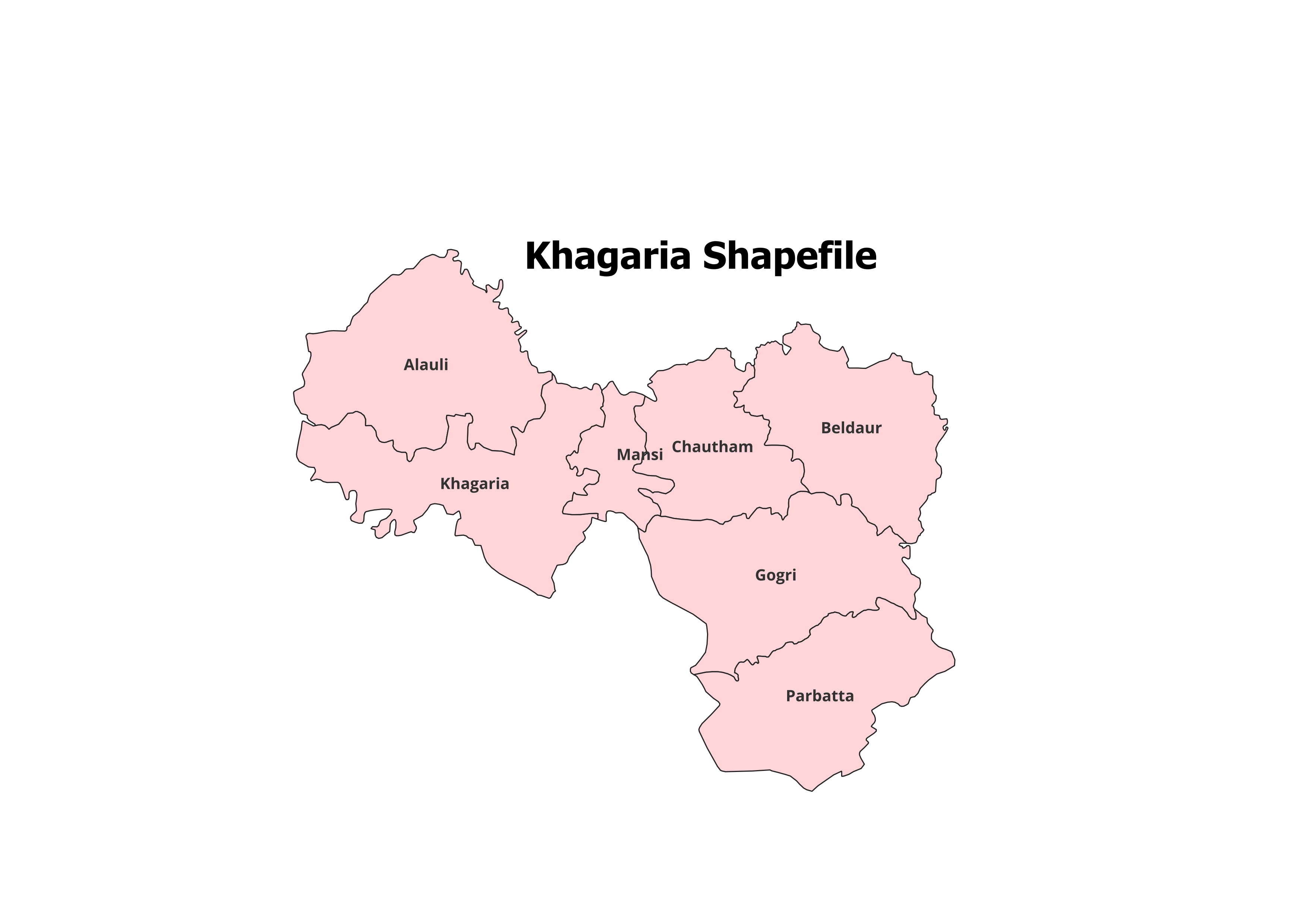
Unlock the detailed geographic structure of Khagaria District with our high-quality shapefile. This dataset includes the administrative boundaries of Khagaria District and its 7 Blocks, ideal for GIS professionals, researchers, and students.
Key Features:
- Complete Block-Level Coverage: Includes all 7 blocks of Khagaria District.
- Accurate and Verified Data: Perfect for academic, research, and personal projects.
- GIS-Ready Format: Compatible with leading GIS tools like QGIS, ArcGIS, and more.
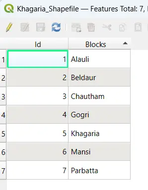
- Detailed Attributes: Contains block names and codes for efficient analysis.
- File Format: ESRI Shapefile (.shp) with all necessary supplementary files (.dbf, .shx, .prj).
Applications:
- Research Studies: Useful for analyzing land use, population dynamics, and spatial planning.
- Academic Projects: Ideal for GIS mapping, presentations, and geographical research.
- Non-Commercial Use: Suitable for personal and educational purposes.
Blocks Included in Khagaria District:
- Alauli
- Beldaur
- Chautham
- Gogri
- Khagaria
- Mansi
- Parbatta
Technical Details:
- File Format: ESRI Shapefile (.shp)
- Coordinate System: WGS 84 (EPSG: 4326)
- Resolution: High-quality vector data
- Attributes: Includes block names, codes, and metadata
Important Notes:
- Commercial Use: Not Allowed. This shapefile is intended for academic, research, or personal use only.
- Redistribution or Resale: Strictly prohibited.
What You’ll Receive:
- Shapefile of Khagaria District
- Metadata with block-level attributes
- Easy setup instructions for GIS integration
- Free technical support for troubleshooting and usage
Compatibility:
Compatible with popular GIS tools, including:
- QGIS
- ArcGIS
- Global Mapper
- MapInfo
- AutoCAD Map 3D
Licensing:
- Personal and Academic Use Only
- Redistribution, resale, or commercial use is strictly prohibited.
Tanvi (verified owner) –
I downloaded ecological shapefiles for a conservation project and the quality was fantastic.
Shruti (verified owner) –
A must-visit site for anyone in need of high-quality geospatial data. Amazing collection.
Pooja (verified owner) –
I was surprised by the variety of datasets available. Great platform for GIS professionals and students.
Anjali (verified owner) –
I was impressed by the range of regional shapefiles available here. Found exactly what I needed.
Aditya (verified owner) –
I was impressed by how organized and detailed the metadata was for each shapefile.
Rachna (verified owner) –
This site made my GIS project much easier. The datasets are precise and easy to work with.
Arjun (verified owner) –
It’s hard to find such accurate and reliable GIS datasets online. This site is a gem.