

Description
Product Description:
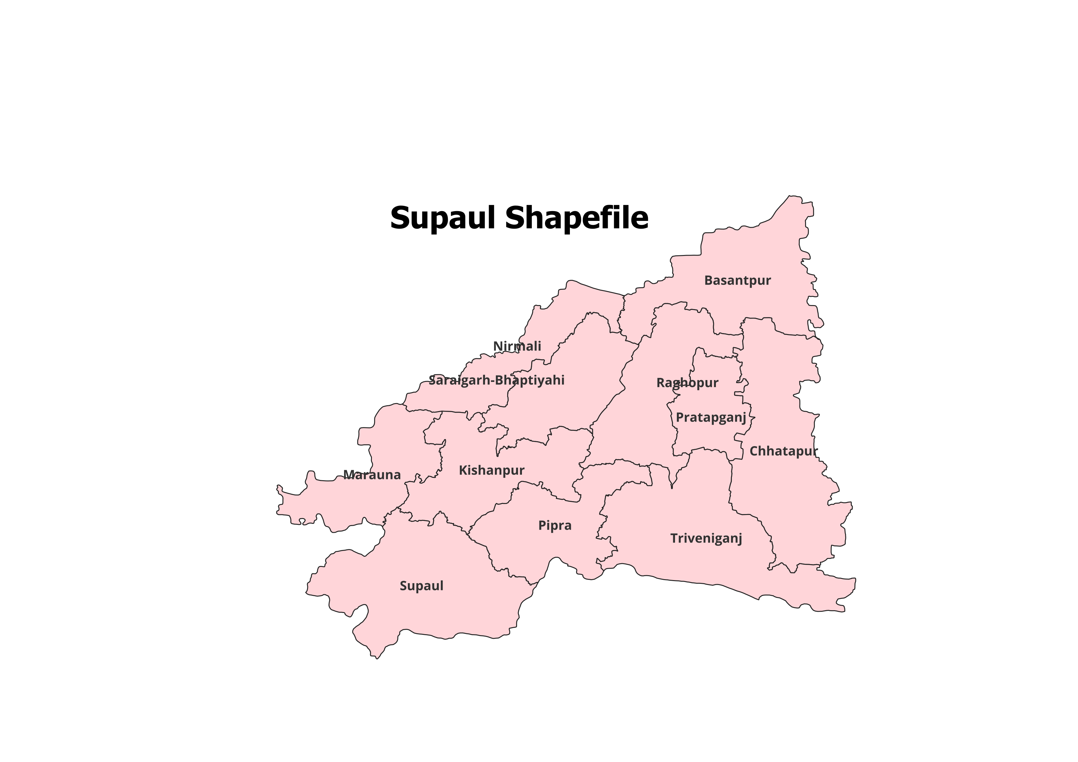
Explore the intricate geographic structure of Supaul District with our premium shapefile. This dataset features the administrative boundaries of Supaul District and its 11 Blocks, tailored for GIS professionals, researchers, and students.
Key Features:
- Complete Block-Level Coverage: Includes all 11 blocks of Supaul District.
- Accurate and Verified Data: Ideal for academic, research, and personal projects.
- GIS-Ready Format: Compatible with leading GIS tools like QGIS, ArcGIS, and more.
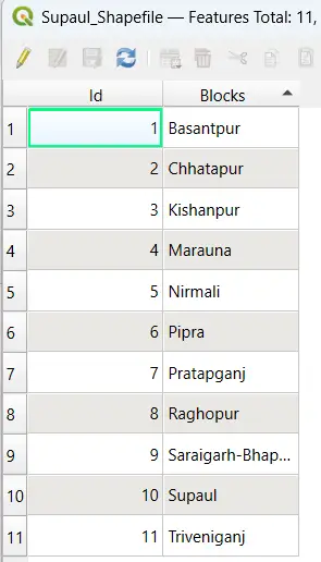
- Detailed Attributes: Contains block names and codes for efficient analysis.
- File Format: ESRI Shapefile (.shp) with all necessary supplementary files (.dbf, .shx, .prj).
Applications:
- Research Studies: Perfect for analyzing land use, population patterns, and spatial planning.
- Academic Projects: Essential for GIS mapping, presentations, and geographical research.
- Non-Commercial Use: Best suited for personal and educational purposes.
Blocks Included in Supaul District:
- Basantpur
- Birpur
- Chhatapur
- Marauna
- Nirmali
- Pipra
- Raghopur
- Supaul
- Kishanpur
- Triveniganj
- Pratapganj
Technical Details:
- File Format: ESRI Shapefile (.shp)
- Coordinate System: WGS 84 (EPSG: 4326)
- Resolution: High-quality vector data
- Attributes: Includes block names, codes, and metadata
Important Notes:
- Commercial Use: Not Allowed. This shapefile is intended for academic, research, or personal use only.
- Redistribution or Resale: Strictly prohibited.
What You’ll Receive:
- Shapefile of Supaul District
- Metadata with block-level attributes
- Easy setup instructions for GIS integration
- Free technical support for troubleshooting and usage
Compatibility:
Compatible with popular GIS tools, including:
- QGIS
- ArcGIS
- Global Mapper
- MapInfo
- AutoCAD Map 3D
Licensing:
- Personal and Academic Use Only
- Redistribution, resale, or commercial use is strictly prohibited.
Sakshi (verified owner) –
The variety and accuracy of the shapefiles here are unmatched. Great job.
Jatin (verified owner) –
This platform provides high-quality data at reasonable prices. A go-to site for geospatial data.
Shubham (verified owner) –
Perfect for GIS professionals and beginners alike. Easy navigation and excellent data quality.
Geeta (verified owner) –
I was amazed by the level of detail in the shapefiles. They made my analysis much easier.
Aryan (verified owner) –
I was impressed by the range of regional shapefiles available here. Found exactly what I needed.
Sneha (verified owner) –
Quick downloads, detailed datasets, and great support. This website is a go-to for GIS data.
Deepak (verified owner) –
I had an issue with my download but customer support resolved it quickly. Great service.