

Description
Product Description:
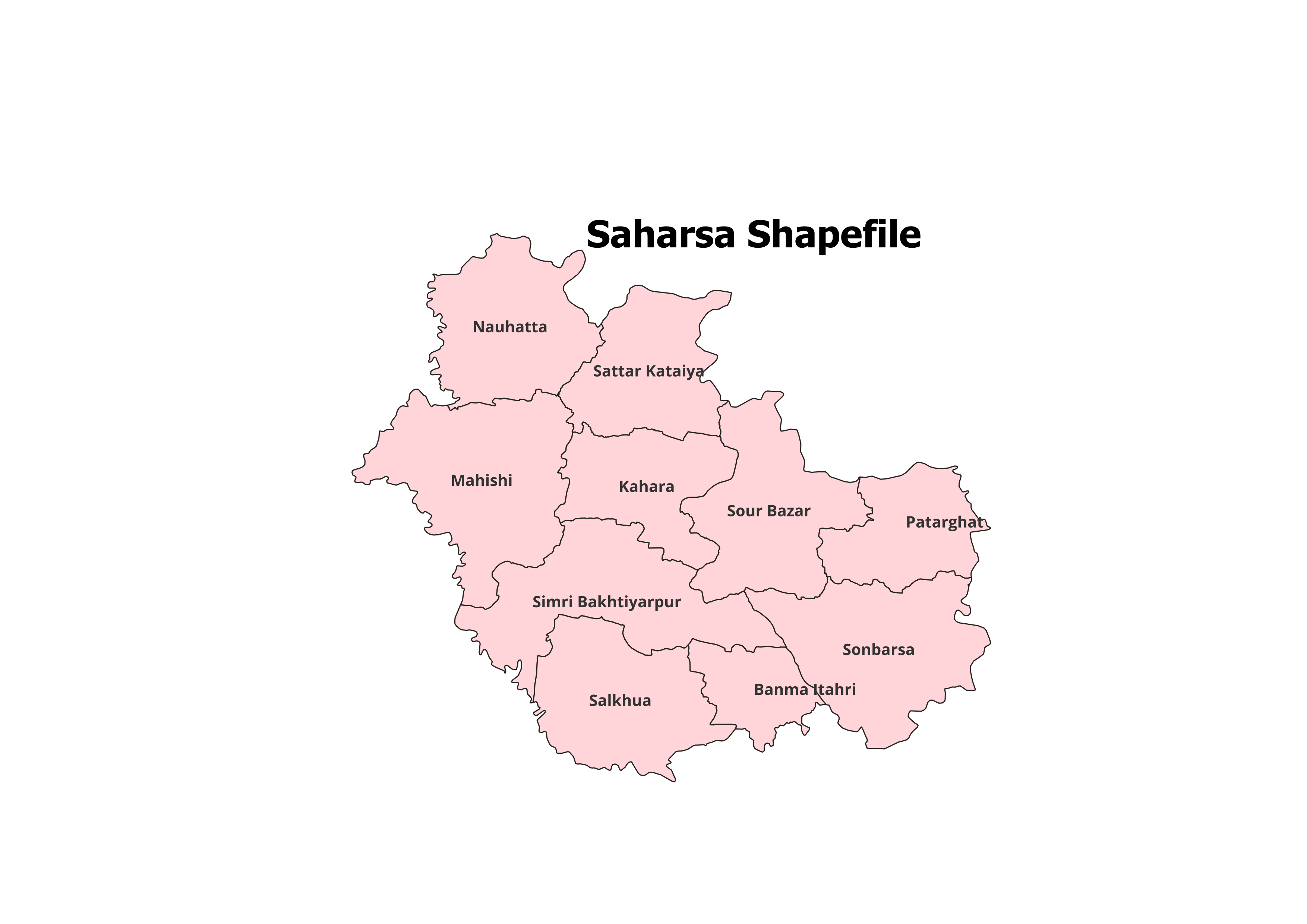
Get access to the detailed geographic layout of Saharsa District with our professionally crafted shapefile. This dataset includes the administrative boundaries of Saharsa District and its 10 Blocks, designed for GIS professionals, researchers, and students.
Key Features:
- Complete Block-Level Coverage: Includes all 10 blocks of Saharsa District.
- Accurate and Verified Data: Ideal for academic, research, and personal projects.
- GIS-Ready Format: Compatible with leading GIS tools like QGIS, ArcGIS, and more.
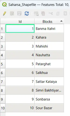
- Detailed Attributes: Contains block names and codes for efficient analysis.
- File Format: ESRI Shapefile (.shp) with all necessary supplementary files (.dbf, .shx, .prj).
Applications:
- Research Studies: Perfect for analyzing land use, population patterns, and spatial planning.
- Academic Projects: Essential for GIS mapping, presentations, and geographical research.
- Non-Commercial Use: Best suited for personal and educational purposes.
Blocks Included in Saharsa District:
- Banma Itahari
- Kahara
- Mahishi
- Nauhatta
- Pattarghat
- Saharsa
- Salkhua
- Simri Bakhtiarpur
- Saur Bazar
- Sonbarsa
Technical Details:
- File Format: ESRI Shapefile (.shp)
- Coordinate System: WGS 84 (EPSG: 4326)
- Resolution: High-quality vector data
- Attributes: Includes block names, codes, and metadata
Important Notes:
- Commercial Use: Not Allowed. This shapefile is intended for academic, research, or personal use only.
- Redistribution or Resale: Strictly prohibited.
What You’ll Receive:
- Shapefile of Saharsa District
- Metadata with block-level attributes
- Easy setup instructions for GIS integration
- Free technical support for troubleshooting and usage
Compatibility:
Compatible with popular GIS tools, including:
- QGIS
- ArcGIS
- Global Mapper
- MapInfo
- AutoCAD Map 3D
Licensing:
- Personal and Academic Use Only
- Redistribution, resale, or commercial use is strictly prohibited.
Gaurav (verified owner) –
I’ve used many sources for GIS data, but this site stands out for its accuracy and simplicity.
Gaurav (verified owner) –
I downloaded land-use data and it integrated seamlessly into my GIS software. Perfect.
Vikram (verified owner) –
The road network shapefiles I purchased worked perfectly for my urban planning project.
Vikas (verified owner) –
The best platform for high-quality GIS shapefiles. Everything I needed was easy to find and download.
Vishal (verified owner) –
The best platform for high-quality GIS shapefiles. Everything I needed was easy to find and download.
Vikas (verified owner) –
Excellent customer service and top-notch datasets. Highly recommend this website.
Jatin (verified owner) –
The shapefiles here are worth every penny. Great resource for anyone working with GIS.