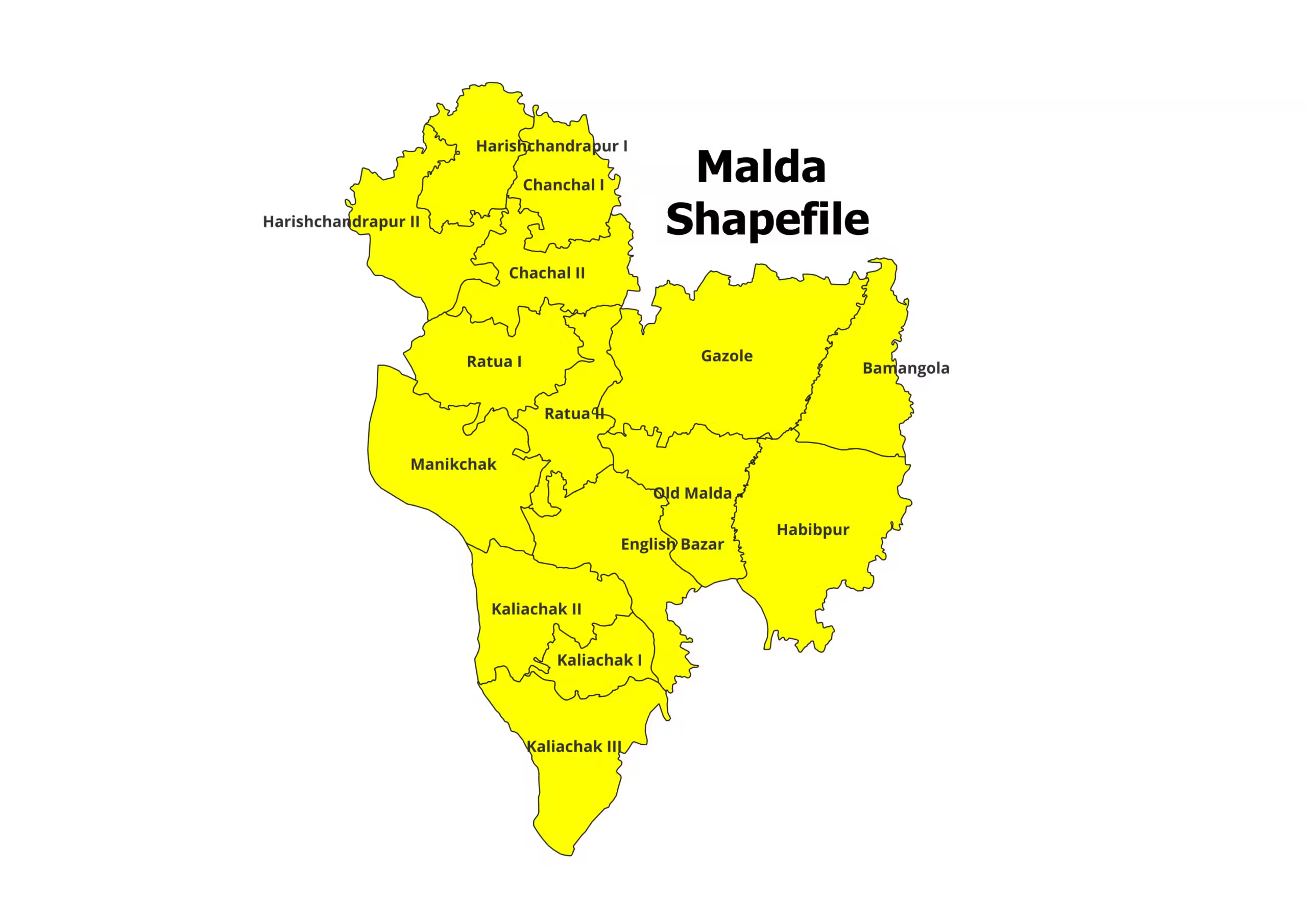
Malda District and Blocks Shapefile (2026)
Are you working on a project related to the Malda district in West Bengal, India? Do you need the Malda…
Read More Are you working on a project related to the Malda district in West Bengal, India? Do you need the Malda…
Read More
District shapefiles are an essential resource for various applications. In the context of West Bengal, District shapefiles including Blocks Shapefiles…
Read More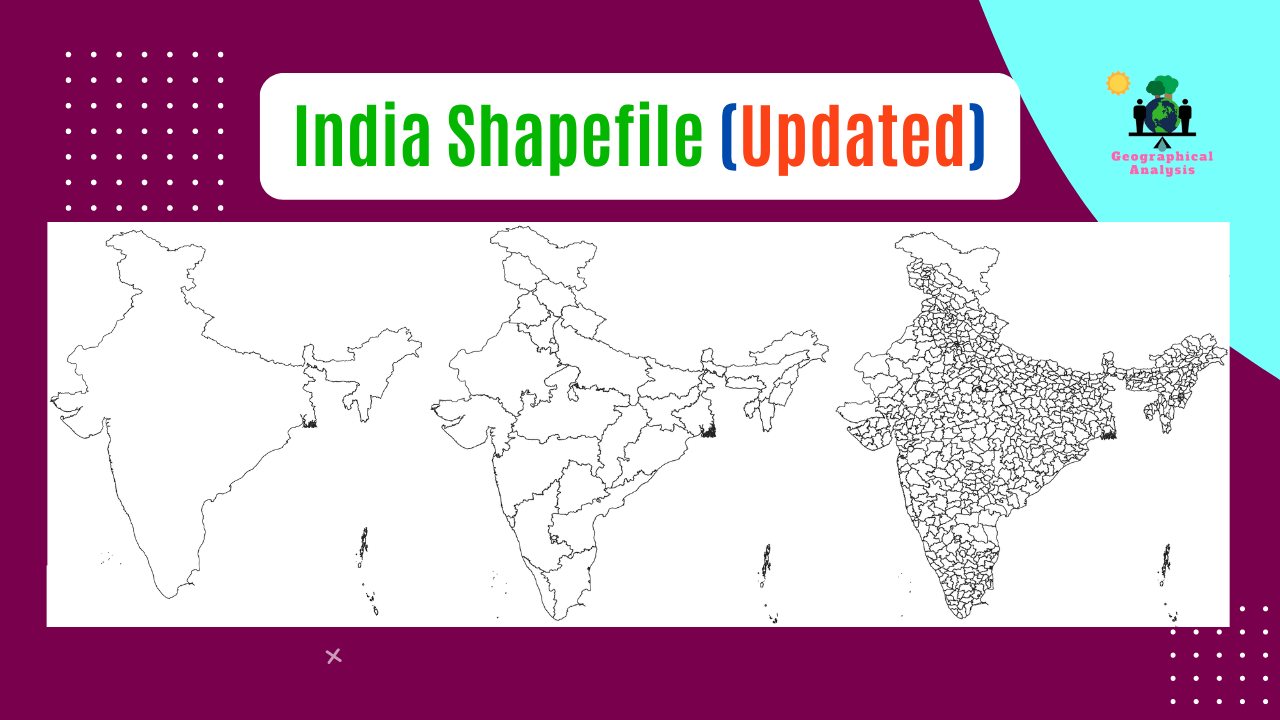
Three types of shapefiles are available here. Visit our Product Page: At the moment, India consists of 28 states and…
Read MoreAs you research into the world of geospatial analysis, you may find yourself limited by the capabilities of Google Earth…
Read More
We need shapefile for GIS related task. You can download India shapefile including Kashmir and Ladakh. India state shapefile download…
Read More
As you research into the world of geospatial analysis, you may find yourself limited by the capabilities of Google Earth…
Read More
We all know that tile is a very important part of QGIS. For many purposes, we need various types of…
Read More
Celebrate the versatility of QGIS by exploring the top 10 most popular QGIS Plugins that have revolutionized geospatial analysis. These…
Read More
Innovations in Geographic Information Systems (GIS) technology have created exciting possibilities for the future of GIS mapping and spatial analysis….
Read More
Just as technology advances, so does environmental conservation. Geographic Information Systems (GIS) have revolutionized the way we monitor, analyze, and…
Read MoreOur main motive is to share some valuable information and knowledge about various Geographical Phenomenon. Day by day we will cover more topics as possible.