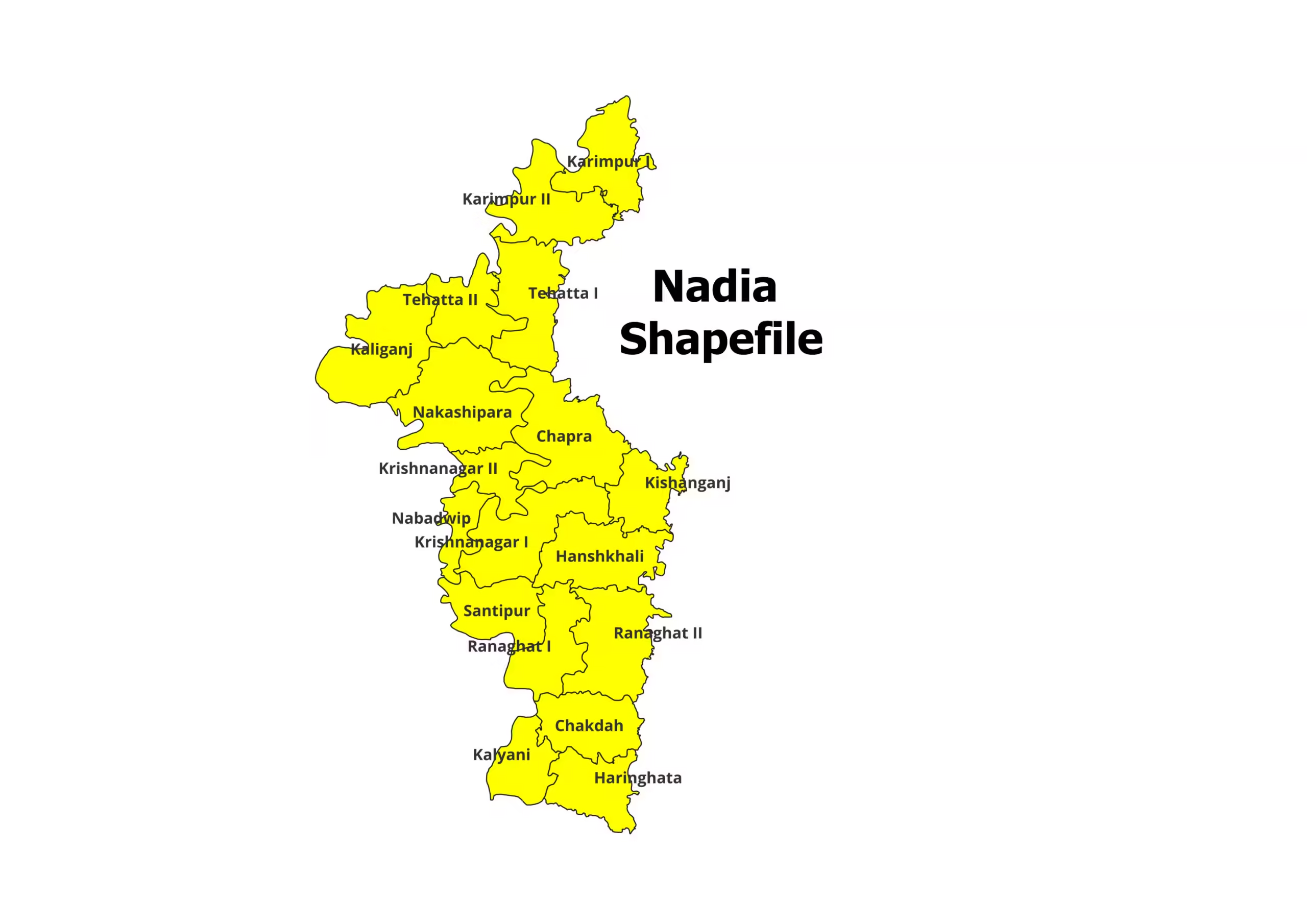
Nadia District and Blocks Shapefile (2026)
Are you working on a project related to the Nadia district in West Bengal, India? Do you need the Nadia…
Read More Are you working on a project related to the Nadia district in West Bengal, India? Do you need the Nadia…
Read More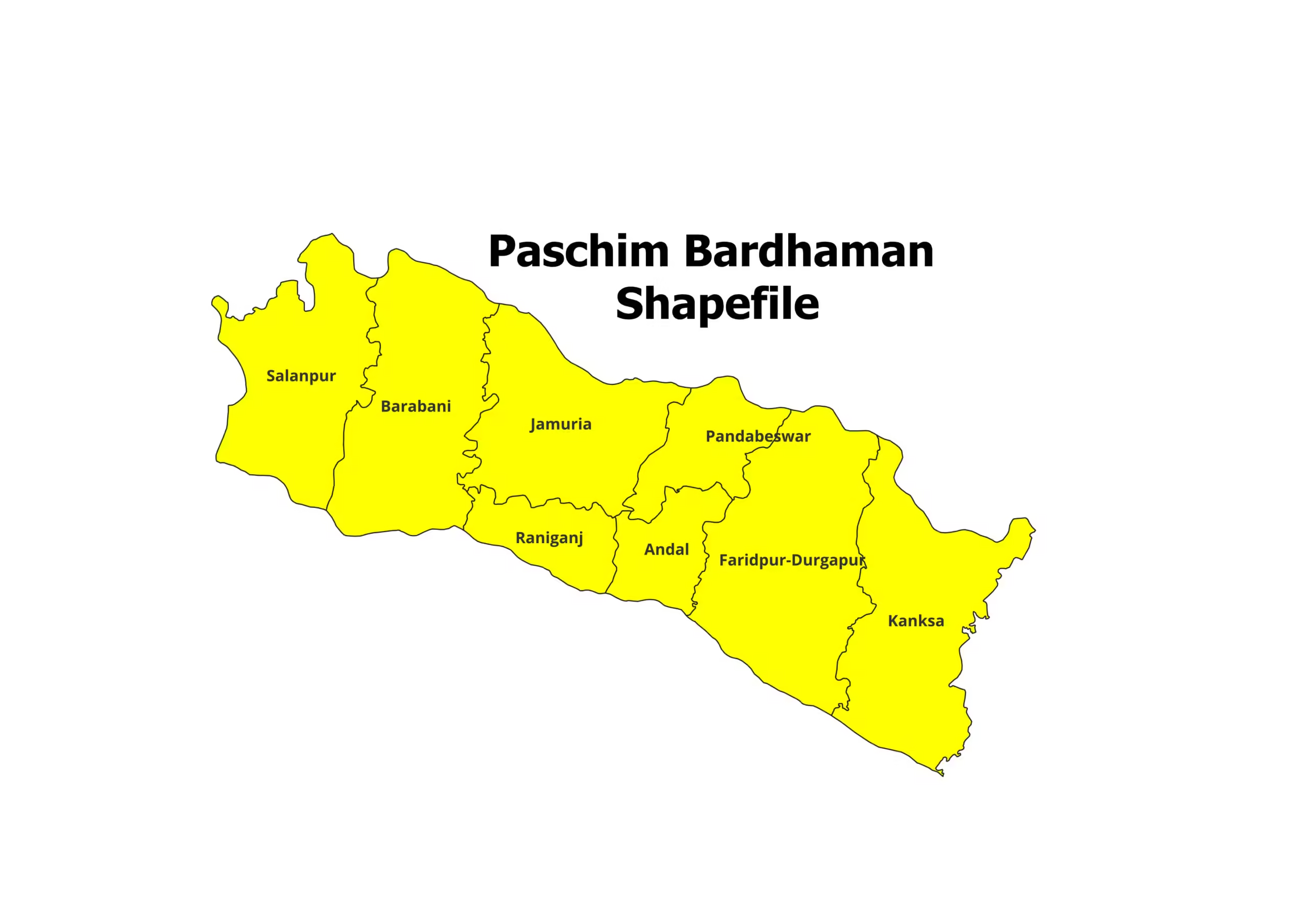
Are you working on a project related to the Paschim Bardhaman district in West Bengal, India? Do you need the…
Read More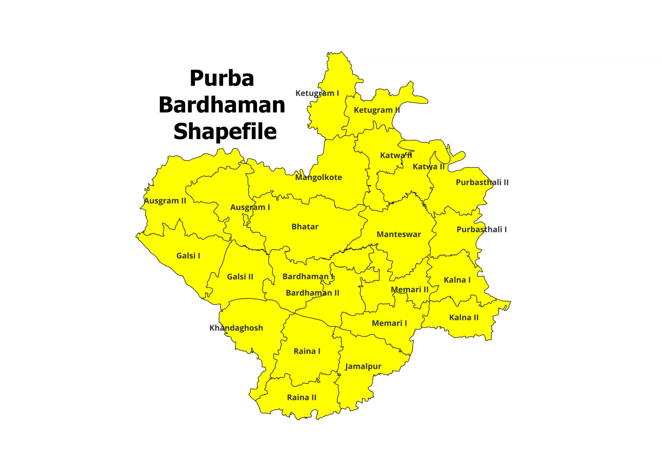
Are you working on a project related to the Purba Bardhaman district in West Bengal, India? Do you need the…
Read More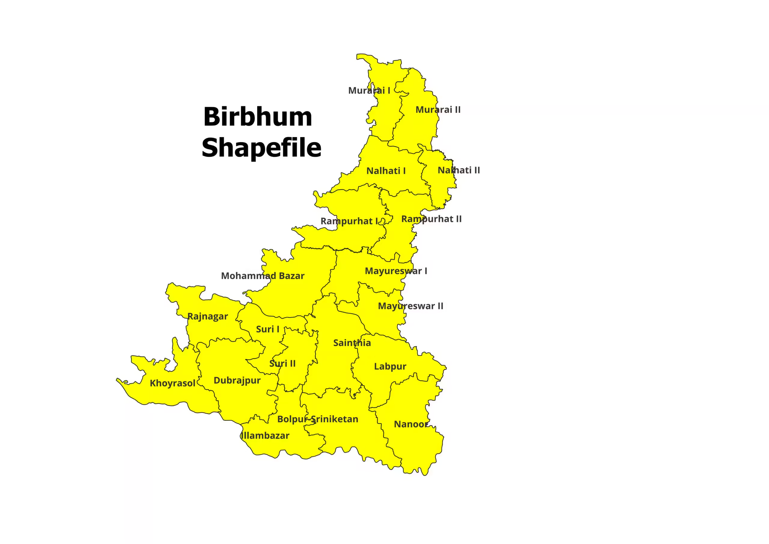
Are you working on a project related to the Birbhum district in West Bengal, India? Do you need the Birbhum…
Read More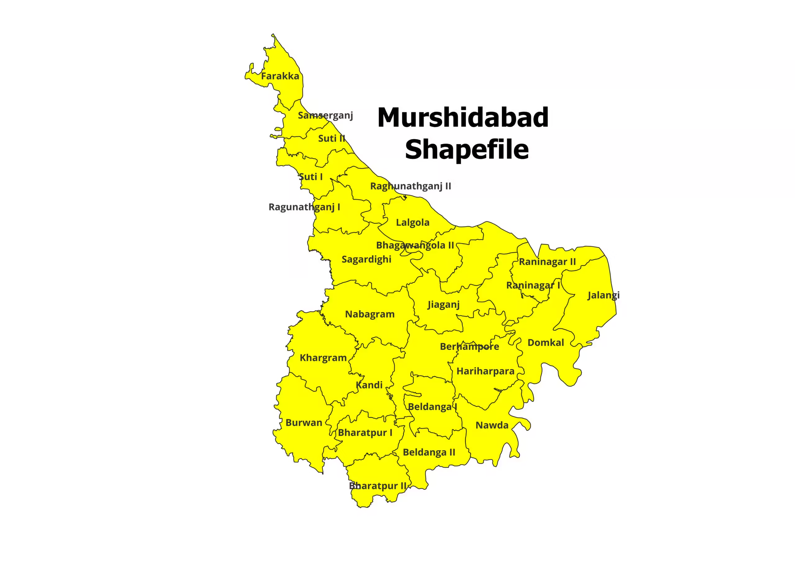
Are you working on a project related to the Murshidabad district in West Bengal, India? Do you need the Murshidabad…
Read More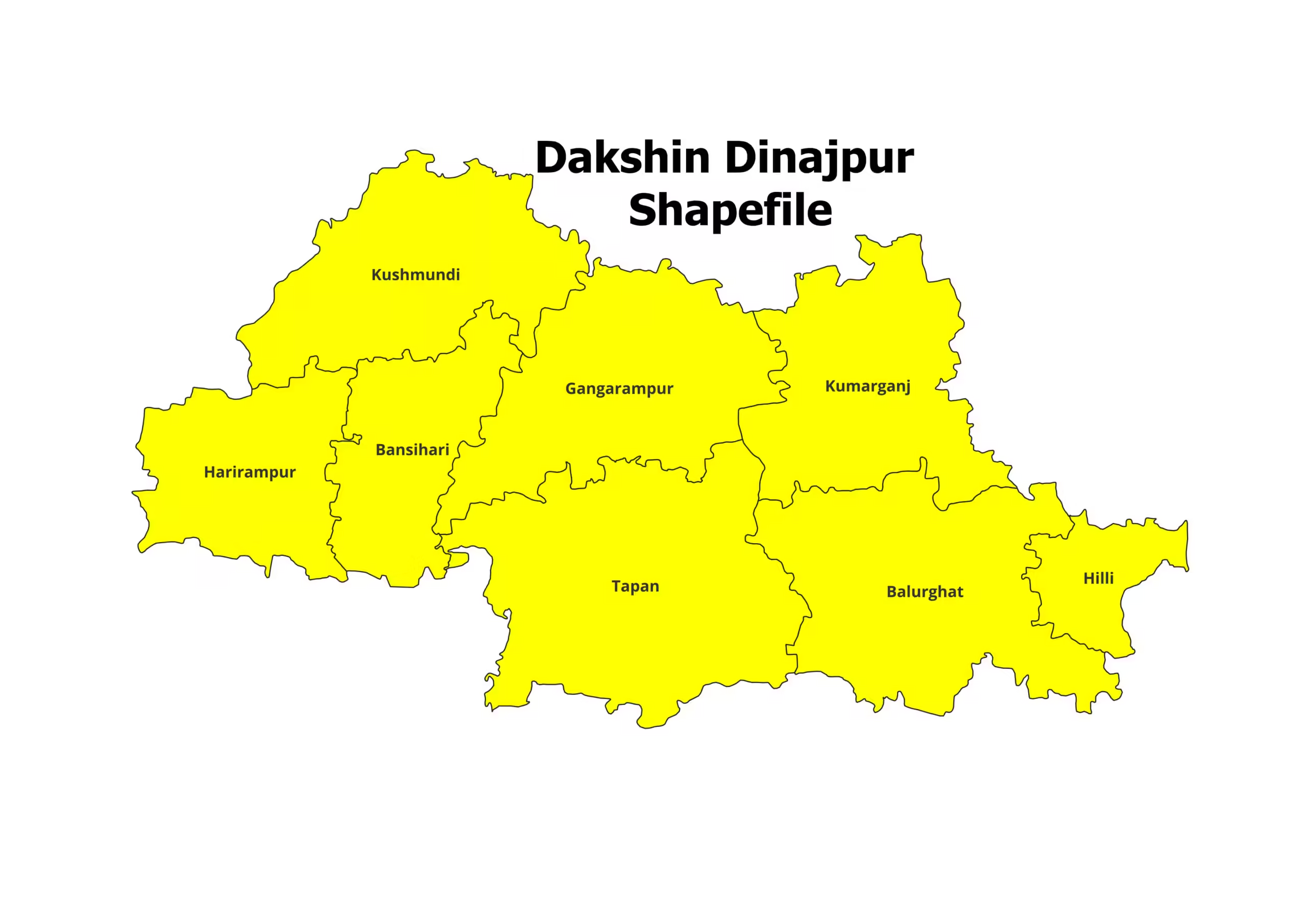
Are you working on a project related to the Dakshin Dinajpur district in West Bengal, India? Do you need the…
Read More
Bihar Districts shapefiles are a crucial asset for various applications, particularly in the realm of geographic information systems (GIS). In…
Read More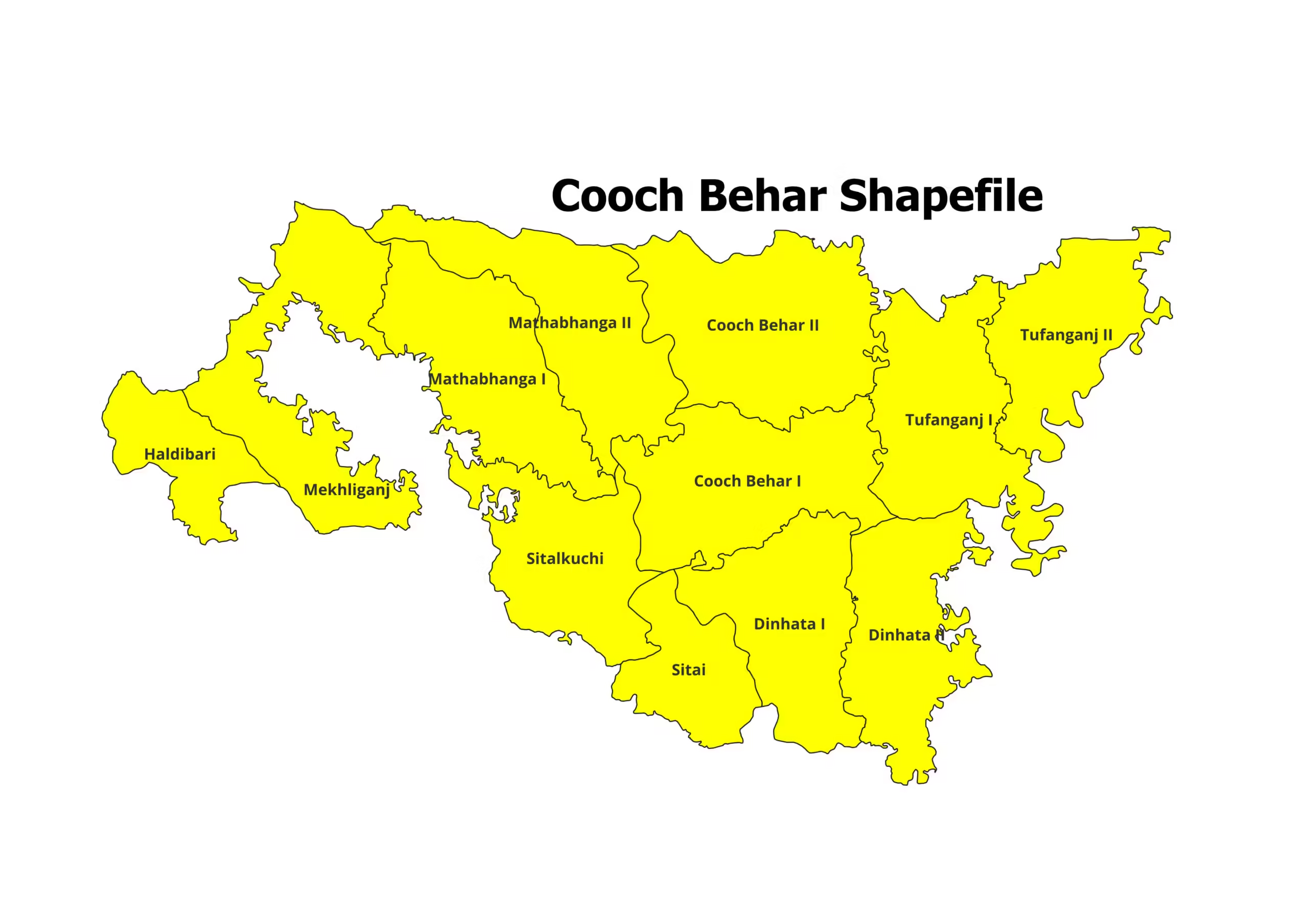
Are you working on a project related to the Cooch Behar district in West Bengal, India? Do you need the…
Read More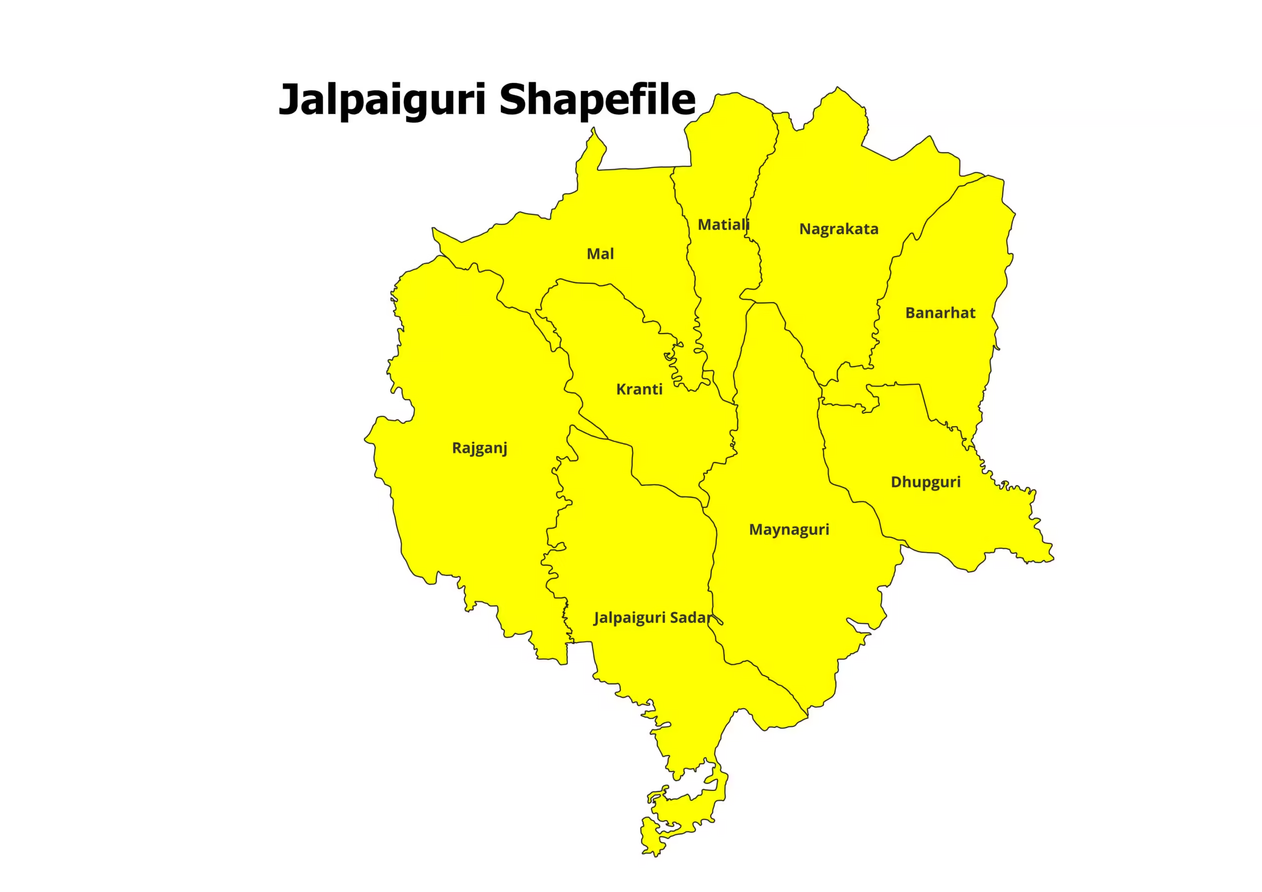
Are you working on a project related to the Jalpaiguri District in West Bengal, India? Do you need the Jalpaiguri…
Read More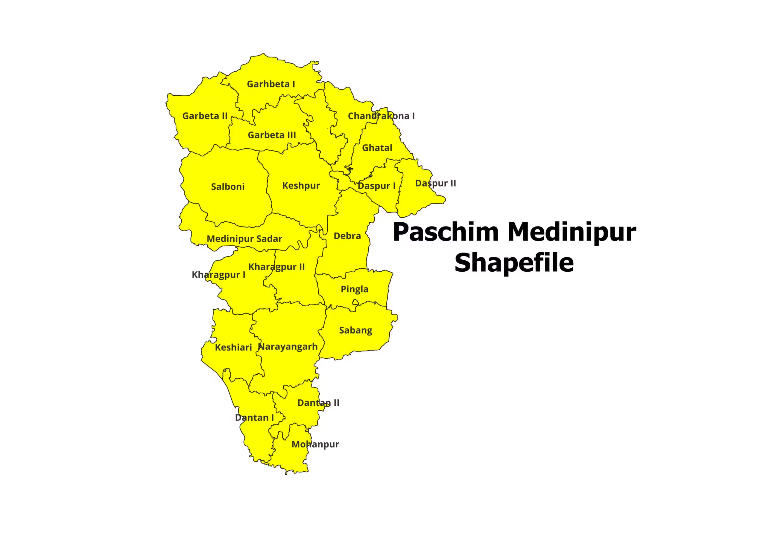
Are you working on a project related to the Paschim Medinipur district in West Bengal, India? Do you need the…
Read MoreOur main motive is to share some valuable information and knowledge about various Geographical Phenomenon. Day by day we will cover more topics as possible.